Figures & data
Figure 1. The location of Crowland on the western fen edge, with other key sites mentioned in the text (authors, adapted from Oosthuizen Citation2016).
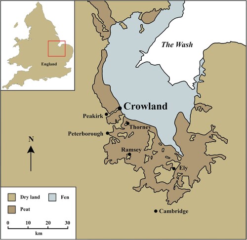
Figure 2. The early Medieval topography of Crowland “island” (authors, based on Geological Map Data BGS © UKRI 2024).
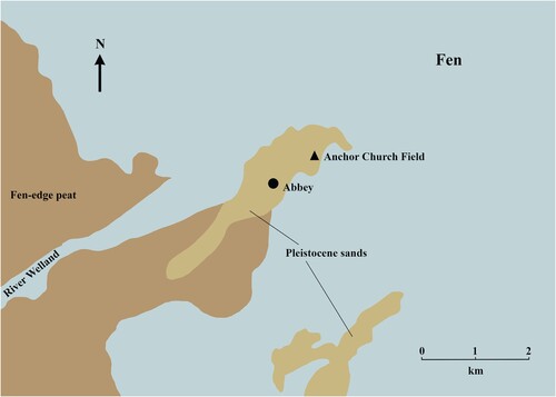
Figure 3. Stukeley’s view of Anchor Church Field, 26th September 1735 (British Library MS 51048, f. 57r).
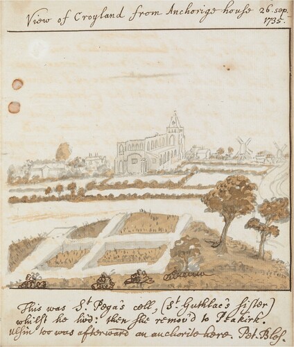
Figure 4. The illustration of structures at Anchor Church Field drawn by Canon Moore, who believed the site to be “Guthlac’s cell.” While elements of the plan prove useful, our excavations make clear that Moore conflated two buildings into one on this plan (Moore Citation1879).
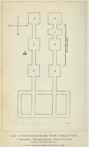
Figure 5. Top: satellite imagery of Anchor Church field in 2004 and 2005 (© Maxar Technologies and Infoterra Ltd & Bluesky). Note the recently backfilled evaluation trenches. Bottom: Plan of trench locations and archaeological features at Anchor Church Field. Features were located through a combination of geophysical survey (Linford and Linford Citation2002), satellite imagery (Maxar Technologies and Infoterra Ltd & Bluesky), and our excavations.
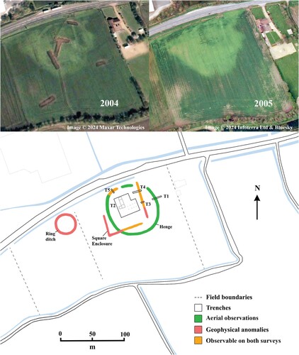
Figure 6. Ditch sections from the henge (Trench 1) and early Medieval enclosure (Trenches 3 and 4) (authors).
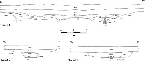
Figure 7. 14C dating of wooden post from Trench 1 (Beta Lab. No. 664348).
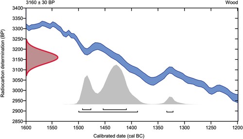
Figure 8. Fragments of late 7th–early 9th century a.d. vessel glass from Trench 2 (authors).
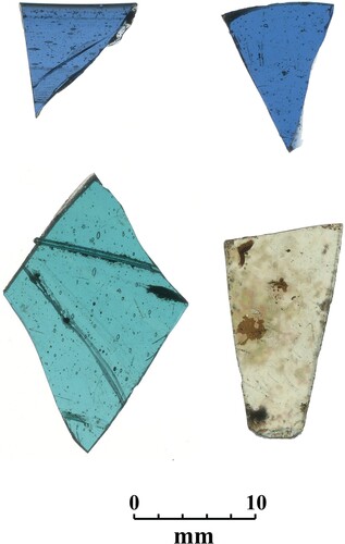
Figure 9. Concentration of tile tesserae with degraded mortar to the right in Trench 2 (authors).
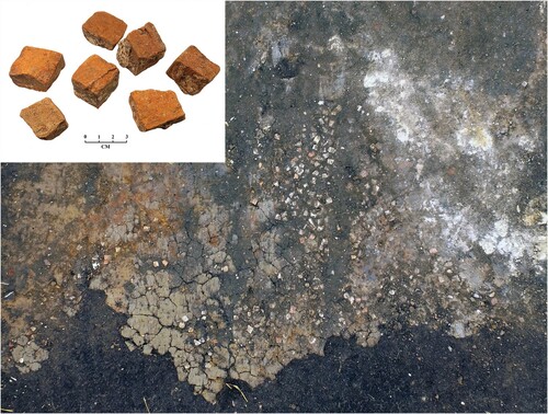
Figure 10. Building A on initial clearance (authors).
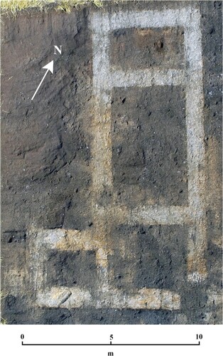
Figure 11. Building B after excavation (authors).
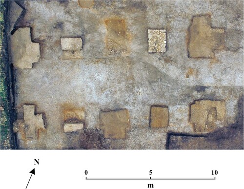
Figure 12. Plan of the excavated later Medieval hall and chapel (authors).
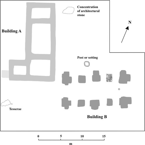
Figure 13. Reconstruction of the Medieval chapel, depicting the proposed quadripartite arrangement of the vault (authors).
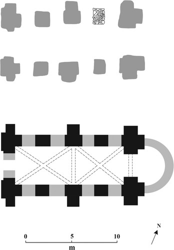
Figure 14. Plan of Minster Court, Thanet, which bears close resemblance to the 12th century a.d. complex at Anchor Church Field (authors, after Kipps Citation1929, pl. 1).
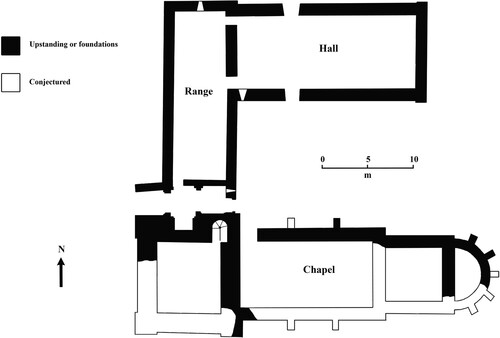
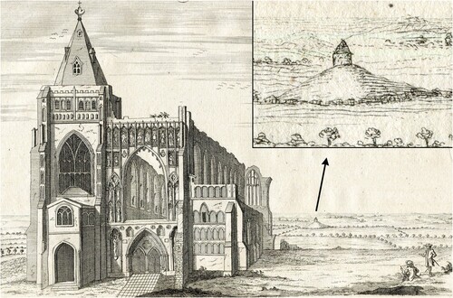
Figure 15. Stukeley’s view of the western prospect of Crowland Abbey, 14th July 1724, including a depiction of a building at Anchor Church Field located on a distinctive mound (Stukeley Citation1776, pl. 4:2d)