Figures & data
Figure 1. Trade-off between depth and coverage in single-source or bespoke integration data.
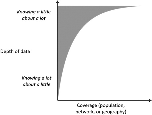
Figure 2. Multi-source, multi-use integrated data to develop rich information.
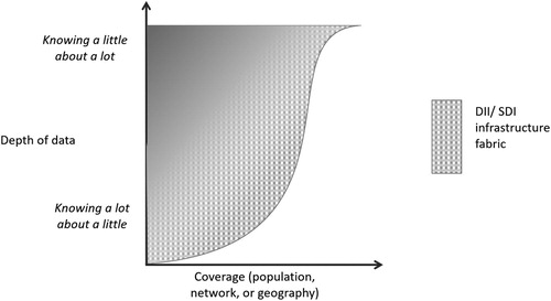
Figure 3. Overview of New Zealand’s digital information infrastructure (including geospatial information) with examples grouped as per the sociotechnical systems approach.
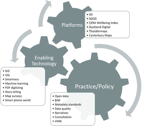
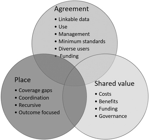
Figure 4. Emerging themes and associated challenges for improving digital information infrastructure in New Zealand.