Figures & data
Figure 1. Bangka and Belitung Islands, Indonesia.
Source: Map by authors using data from Esri, Garmin, USGS, and UC Berkeley.
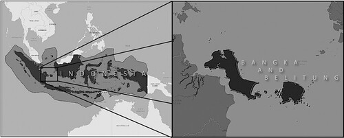
Figure 2. A flattened, two-dimensional map representing Marine Spatial Planning (MSP) off and on the Bangka and Belitung Islands.
Source: PERDA (2020) and the MSP publication permission is given by the Department of Fisheries and Marine at the province level on Bangka and Belitung Islands, Indonesia.
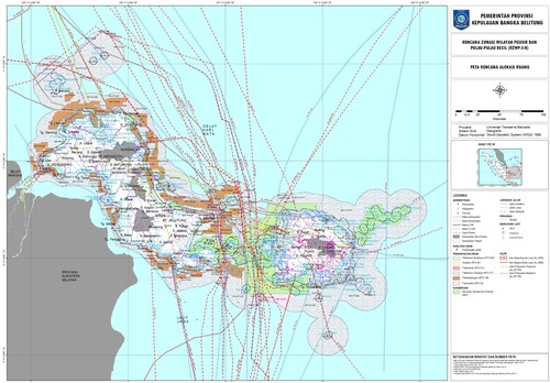
Figure 3. A tin diving member sitting atop seabed sediments mixed with tin ores on a wooden floating raft, holding a yellow breathing pipe.
Source: Personal documentation, 2022.
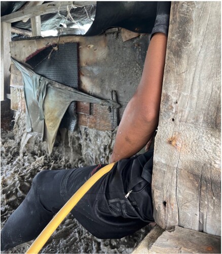
Figure 4. The process of descending into the seabed pit. (a) A tin diver is wearing a wet suit on a wooden floating raft offshore. (b) Using a rope tied to a cemented weight to orient the diver’s body to the seabed pit to avoid getting swept away by the ocean current using the rope to orient the diver’s body to the seabed pit. (c) As the tin diver goes deeper using the rope, the water's colour changes to green. (d) The water then changes to yellow. (e) The water's colour turns grey as the tin diver approaches the seabed pit. (f) When the tin diver reaches the seabed pit, the water's colour turns dark.
Source: Personal documentation, 2022.
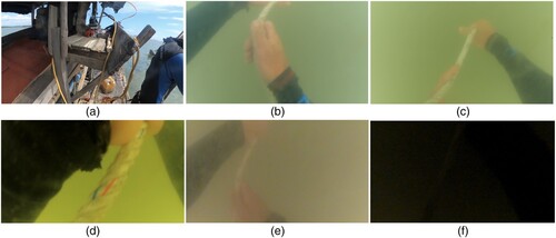
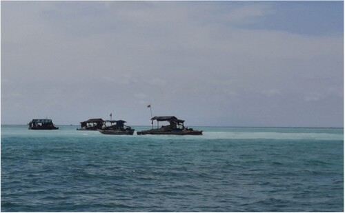
Figure 5. Tin floating rafts operating offshore Bangka and Belitung Islands.
Source: Personal documentation, 2022.