
Figures & data
Figure 1. Rivers, lakes, and ponds in the Rapti river plain.

Figure 2. Lakes in 1969 and 2019 in the study site.
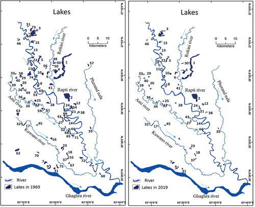
Figure 3. Lakes transformation into large pond and disappeared lakes within 50 years (1969–2019).
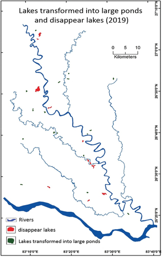
Table 1. Change in area of lakes within 50 years (1969 – 2019).
Figure 4. Lakes transformed into different extent; current lakes, large ponds and disappeared lakes within 50 years (1969 – 2019) in Tarai region.
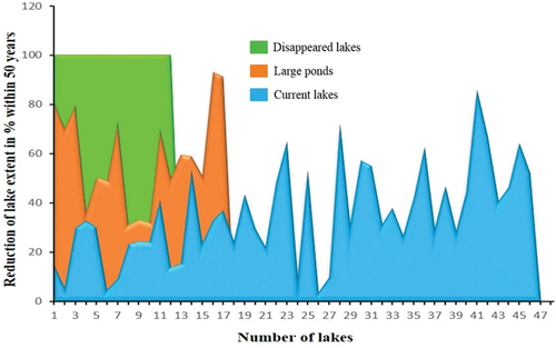
Table 2. Transformation of lake into large pond within 50 years (1969 – 2019).
Figure 5. Change in identifiable nomenclature of lakes within 50 years (1969 to 2019).
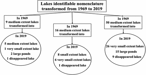
Figure 6. Spatial vulnerability index of alive lakes during 50 years (1969 – 2019).
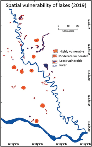
Figure 7. Regression analysis between reduced lake extent (50 years) and morphometric parameters of lakes in Tarai region.
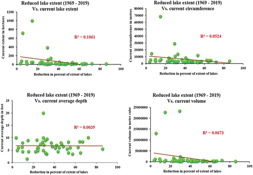
Table 3. Spatial vulnerability index of alive lakes during 50 years (1969–2019).
Corrected table of paperhighlightedCleanVersion.docx
Download MS Word (36.8 KB)Data availability statement
Data will be made available if asked and required.