
Abstract
City lights, fishing boats, and oil fields are the major sources of nighttime lights, therefore the nighttime light images provide a unique source to map human beings and their activities from outer space. While most of the scholars focused on application of nighttime light remote sensing in urbanization and regional development, the actual fields are much wider. This paper summarized the applications of nighttime light remote sensing into fields such as the estimation of socioeconomic parameters, monitoring urbanization, evaluation of important events, analyzing light pollution, fishery, etc. For estimation of socioeconomic parameters, the most promising progress is that Gross Domestic Product and its growth rate have been estimated with statistical data and nighttime light data using econometric models. For monitoring urbanization, urban area and its dynamics can be extracted using different classification methods, and spatial analysis has been employed to map urban agglomeration. As sharp changes of nighttime light are associated with important socioeconomic events, the images have been used to evaluate humanitarian disasters, especially in the current Syrian and Iraqi wars. Light pollution is another hotspot of nighttime light application, as the night light is related to some diseases and abnormal behavior of animals, and the nighttime light images can provide light pollution information on large scales so that it is much easier to analyze the effects of light pollutions. In each field, we listed typical cases of the applications. At last, future studies of nighttime light remote sensing have been predicted.
1. Introduction
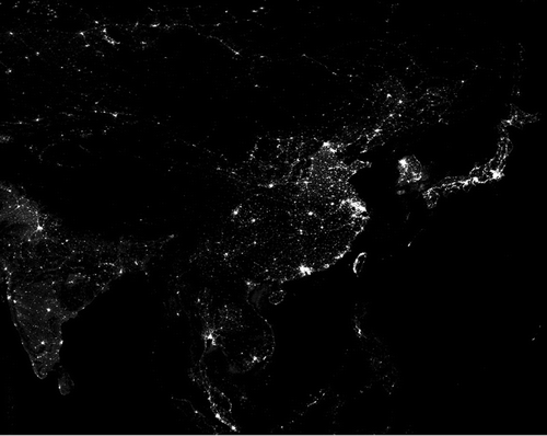
The US Defense Meteorological Satellite Program (DMSP) started in the 1970s. Its Operational Linescan System (OLS) was designed to capture the faint moonlight reflected from clouds at night, in order to gain the night clouds’ distribution information. However, scientists occasionally discovered that DMSP/OLS can record city lights and other light-emitting at cloud-free night (see Figure ), which is the origin of the nighttime light remote sensing (Welch Citation1980). So far, there have been some earth observation sensors that can obtain the earth imagery of visible and near-infrared bands at night, including the DMSP/OLS and the International Space Station (ISS).
Figure 1. The DMSP/OLS nighttime image of Eastern Asia.
In addition to reflecting night city lights, nighttime light imagery can also capture fishing boat lights, natural gas combustion, forest fires, and other lights. Therefore, they are widely used in fields of socioeconomic parameters estimation, regional development, event evaluation, and fishery monitoring. Compared to general remote sensing satellite imagery, nighttime light remote sensing imagery can more reflect human activity. They have been widely used in the studies of social science. The rest part of this article will introduce and summarize these studies. It is worth noting that, despite the fact that the sources of nighttime light remote sensing imagery have expanded from traditional DMSP/OLS imagery to multi-source imagery, DMSP/OLS imagery with advantages of rich historical archived data and wide spatial cover, and yet most nighttime light remote sensing researches continue to be carried out based on such imagery.
2. Socioeconomics
Traditional ways of quantifying socioeconomic variables are always lacking of accuracy and spatial information, and nighttime light images provide potential possibilities to quantify these variables. There is a positive correlation between nighttime light remote sensing imagery and human activity. Because of the advantages in spatiotemporal continuity, independence, and objectiveness, nighttime light remote sensing images can provide important foundation to estimate Gross Domestic Product (GDP), population, electric power consumption, greenhouse gas emission, poverty index, and other social economic parameters.
2.1. Economy
Nighttime light is a proxy for regional economy as density of lighting facilities can reflect the prosperity of a region. A large number of statistical studies demonstrate that there is high correlation between nighttime lights and GDP or Gross Regional Product (GRP). Elvidge et al. (Citation1997) made used of the DMSP/OLS nighttime light imagery of 21 countries in the Americas to do regression analysis, and the coefficient of determination between light-emitting area and GDP is 0.97. Since then, similar researches were carried out in the European Union (Doll, Muller, and Morley Citation2006), China (Li, Xu, et al. Citation2013), the United States (Forbes Citation2013), and other countries, in which the coefficients of determination between the total nighttime lights and GDP are between 0.8 and 0.9 for these regions.
These researches indicate that it is feasible to use nighttime lights to estimate GDP or GRP. Compared to the mature statistical systems in developed countries, economic statistical data in many developing countries have large errors and even deficiencies due to the relatively imperfect statistical systems. Therefore, night light can provide foundations for estimation of GDP or GRP in these countries. In 2011, the US top economic journal – American Economic Review published the research from Brown University, and the article made use of remotely sensed nighttime light data to correct the GDP growth rate considering reliability of economic statistics in different countries. For example, the official value of annual GDP growth rate in Myanmar during 1992–2005 is 10.02%, while the annual growth rate corrected by nighttime light data is 6.48% (Henderson, Storeygard, and Weil Citation2012). With the similar principle, Chen and Nordhaus (Citation2011) proposed the use of nighttime light remote sensing data during the period 1992–2008 to improve the quality of global GDP grid products. Nighttime light data can play a very important role in GDP estimation for countries lacking of statistical data. Keola, Andersson, and Hall (Citation2015) extended the above estimation framework by adding land cover data. The output values of agricultural and non-agricultural departments were measured, respectively. And lastly, the study showed the economic growth rate data on subnational regions of Indochina Peninsular countries. Ghosh et al. (Citation2009) focused on an interesting study by applying the regression model of nighttime lights versus national income in United States to Mexico, and finally reached a surprising conclusion that the informal output value of the economy in Mexico is 150% higher than the official national income.
There is high correlation between nighttime lights and population, economy, etc.; therefore, nighttime lights can provide an innovative way for spatializing socioeconomic indicators. Doll, Muller, and Elvidge (Citation2000) studied the linear relationship between population, GDP, greenhouse gas emissions, and the lit area calculated from nighttime light imagery, and then assigned these parameters to 1° × 1° spatial resolution grids to obtain the spatial grid data of global population, GDP, and greenhouse gas emissions. And finally based on the similar theory, the research generated the GDP grid data in European Union domain with a spatial resolution of 5 km × 5 km. Ghosh, Elvidge, et al. (Citation2010) studied the population density, land cover data, and other geographic information that can directly reflect the levels of economic development into account, attempting to establish a more accurate and reliable GDP spatial distribution model.
Considering that nighttime light imagery can well reflect economic development levels within regions, it also has potential to measure the extent of poverty and unbalanced development. Elvidge et al. (Citation2012) used the distribution differences between nighttime lights and population to evaluate unbalanced development at national and regional scales, establishing the Night Light Development Index (NLDI) as an objective and empirical measurement with comparison to the traditional income Gini coefficient and the Human Development Index. The study indicated that NLDI coefficients in Singapore, Puerto Rico, and the United States are the lowest, while in Kiribati, Papua New Guinea, and the Solomon Islands are the largest. Elvidge, Sutton, et al. Citation(2009) estimated the ratio of nighttime lights and population data as an indicator for measuring poverty population, finally generating poverty indexes on global grids and in administrative regions by aggregating these indexes to the national level. Thereby, the global poverty population estimating by these indexes is 2.2 billion in 2006, close to the result from World Bank estimation which is 2.6 billion. Pinkovskiy (Citation2013) utilized DMSP/OLS nighttime data and global population distribution map, finding that borders between rich and poor countries lead to the significant discontinuity of social and economic attributes, and further proposed the cause of this discontinuity is the private ownership. Kroth, Larcinese, and Wehner (Citation2014) used the distribution of nighttime lights to express public resources distribution, and demonstrated that the abolition of racism resulted in equitable distribution of public resources by analyzing the nighttime light data after the abolition of racism in South Africa. However, the main regions supporting the national ruling party (the African National Congress) possess more public resources. Xu et al. (Citation2015) combined DMSP/OLS night light imagery with population data to measure the regional inequality of public services in China at different scales (from the whole state to prefectural regions) during years 2005−2010, and the result showed that the regional inequality for the whole China was reduced within the five-year period.
2.2. Demography
The spatialization of population data can provide key parameters for regional economy, disasters, global changes, and other fields. Sutton et al. (Citation1997) found a high correlation between population density and nighttime light emissions for the continental United States, and the linear regression coefficient of determination is 0.63. A study by Lo using Chinese DMSP/OLS nighttime light imagery in 1997, indicating that nighttime light data can well simulate non-agricultural population at the county level by implementing regression analysis between multiple indexes, including light area, total nighttime lights, average light intensity, nighttime light proportion, total population, and non-agricultural population at both the county and city levels (Lo Citation2001). Combination of nighttime light data with other auxiliary data can help to disaggregate demographic data more accurately. Based on the relationship between nighttime light data and population distribution, Zhuo et al. (Citation2005) divided Chinese counties into three categories by combining nighttime light imagery, vegetation index products, and population statistics. The study also simulated the population density distribution at 1-km resolution grids by establishing different population spatial distribution models. Since then, supported by different geographic information and remote sensing products, a number of researches were carried out to generate different spatial distribution models for many countries, including Brazil (Amaral et al. Citation2006), European Union (Briggs et al. Citation2007), China (Zeng et al. Citation2011; Yang, Yue, and Gao Citation2013) as well as their subregions. The latest research generated the 500 m × 500 m spatial grid population density map of China coastal zone by utilizing new nighttime light imagery – Suomi NPP/VIIRS (Gao et al. Citation2013).
2.3. Energy and carbon
Nighttime light imagery is exploited to reflect the density and extent of lighting facilities. Letu et al. (Citation2010) proposed the use of nighttime light data to estimate electric power consumption. The linear regression coefficients of determination between electric power consumption and total nighttime lights are higher than 0.6 in Japan, China, India, as well as other Asian countries, which initially proved that it is reasonable to use nighttime lights to estimate electric power consumption. Min et al. (Citation2013) studied the relationship between rural electrification rate and DMSP/OLS nighttime light in Senegal and Mali based on multi-source DMSP/OLS nighttime light imagery. The nighttime lights of electrified villages are consistently brighter than non-electrified villages, which highlights the potential to use night lights imagery for estimating checking global electrification rate. Lo (Citation2002) made regression analysis between the total nighttime lights of DMSP/OLS imagery and electricity consumption of China in 1997, showing that there is close correlation between electric power consumption and these images at the provincial and county’s levels. Shi, Huang, et al. (Citation2014) showed that the total nighttime lights can better simulate GDP and electric power consumption data in provincial units by analyzing the regression relationship between NPP/VIIRS nighttime light data of China and GDP, electric power consumption.
Yang, Kang, et al. (Citation2013) obtained human settlement index from DMSP/OLS imagery, and mapped the electric power consumption at a spatial resolution of 1 km × 1 km of Zhejiang Province in 2010. He et al. (Citation2013) proposed the use of remote sensing vegetation index products to correct saturated data of DMSP/OLS nighttime imagery. In addition, this research also established the relationship between power consumption and total nighttime lights at the provincial level, and obtained the spatial grid data of electric power consumption from 2000 to 2008.
Carbon emission is closely related to human economic activities, as well as economic activities have strong correlation with nighttime lights, therefore nighttime lights can be used to reflect the spatial distribution of carbon emission. Doll, Muller, and Elvidge (Citation2000) found that the coefficient of determination between global carbon emission and total lit area is 0.84, and, the study created global carbon emission grid maps with the resolution of 1° × 1° in 1995 based on the linear relationship. On the basis of the above studies, Ghosh, Powell, et al. Citation(2010) employed nighttime light area data to allocate carbon emission data, and population data were used to allocate the carbon emission data in areas without DMSP-detected lights, and finally generated global carbon emission grid map at 1 km × 1 km resolution. The results are more accurate than the results that derived only from nighttime light data. Su et al. (Citation2013) combined nighttime light data with carbon emission statistic data and Landsat remote sensing imagery, and obtained carbon emission data of prefecture-level cities during 1992–2010. Its results revealed the spatiotemporal characteristics of carbon emission during this period.
3. Regional development
Urbanization is an important driving force for economic development in developing countries, and urbanization has a profound impact on the global and regional climate change. Therefore, monitoring and evaluating urbanization are beneficial to understand global socioeconomic development and climate change. Since towns emit light at night, nighttime light imagery can be used to accurately extract built-up areas and analyze the phenomenon of spatial aggregation (city agglomeration), which has a significant positive effect on understanding global and regional urbanization.
Extent of built-up area is an important parameter for urbanization, and furthermore some studies have shown that nighttime light imagery can effectively extract the extents and variations of built-up areas. The brighter areas in nighttime light images after image segmentation are considered to be the built-up areas (Henderson et al. Citation2003; Small, Pozzi, and Elvidge Citation2005; He et al. Citation2006; Small et al. Citation2011; Yang et al. Citation2011; Zhou et al. Citation2014; Shi, Yu¸ et al. Citation2014). In order to accurately extract built-up areas from nighttime light imagery, further idea is to make full use of other remote sensing products (mainly vegetation index products) and nighttime light imagery simultaneously to establish feature space. Such method has been successfully tested and verified in several countries, such as China (Lu et al. Citation2008; Cao et al. Citation2009; Yang, He, et al. Citation2013) and India (Pandey, Joshi, and Seto Citation2013). Nighttime light imagery can be exploited to extract the extent of built-up areas, while time series of nightly imagery suggests the dynamic information of urbanization. Based on the mapping ability for global urbanization of DMSP/OLS nighttime light imagery (Zhang and Seto Citation2011), Liu et al. (Citation2012) analyzed the spatiotemporal dynamics of China urbanization in the past 20 years. Researches on high-resolution remote sensing data highlight that urbanization detection for developed countries achieved better results than developing countries (Zhang and Seto Citation2013). In addition, nighttime light imagery can also reflect the dynamics of electricity consumption. Li, Chen, Zhao, et al. Citation(2013) evaluated the ability of DMSP/OLS nighttime light imagery to reflect Chinese urbanization at the city level over the period 1994–2009. The results illustrated that nighttime lights, population, electricity consumption, and built-up areas in China have significant relationship in the time dimension (the regression coefficients of determination are generally higher than 0.8). A similar study in Kazakhstan also addressed that time series of nightly imagery can better reflect dynamic changes for urbanization parameters (Propastin and Kappas Citation2012).
Nighttime light imagery can be used not only to monitor urbanization but also to explore the spatiotemporal evolution model of urban agglomerations. Yu et al. (Citation2014) obtained the distribution of China’s major urban agglomerations through spatial cluster analysis for DMSP/OLS imagery, and finally revealed that the five largest urban agglomerations are Shanghai, Zhengzhou, Guangzhou, Beijing, and Shenyang. The method developed by Wei et al. (Citation2014) using pseudo-invariant region did time series analysis for DMSP/OLS nighttime light imagery to obtain spatiotemporal evolution characteristics of the urban agglomeration in the center of Liaoning Province, China. Yi et al. (Citation2014) studied the process of urbanization in China’s northeast region by utilizing DMSP/OLS nighttime light imagery from 1992 to 2010. The article found that the processes of urbanization in Shenyang, Changchun, Harbin, Dalian, Anshan, and Daqing are the fastest by employing unit circle analysis method. Liao, Wei, and Song (Citation2012) reported on the urban spatial distribution pattern of Jiangxi Province based on the DMSP/OLS nighttime light imagery during the period 1994–2009, and concluded its development patterns, including the increasing of connectivities, in contrast to the decreasing of fragmentation degree between towns. Fan et al. (Citation2013) focused on the spatial pattern change study in the Bohai Rim Region using DMSP/OLS nighttime imagery during the period 1992–2010. The results showed that the expansion rates in small cities are relatively higher than big cities, and meanwhile the connectivity between core cities and satellite cities is increasing. Using the DMSP/OLS nighttime light imagery of 1998, 2003, and 2008, Xu et al. (Citation2011) demonstrated three patterns of urban expansion in the Yangtze River Delta region by analyzing its expansion characteristics, and concluded the gradual decrease in urban development unbalance in this region.
Compared to applications of nighttime light remote sensing in urban agglomeration researches, researches on urban system are also carried out. Urban system is composed by a center city as the core and closely interrelated towns of different scale levels with different functions. Nighttime light imagery provides urban size and spatial correlation information, which can effectively support researches on urban system. Small and Elvidge (Citation2013) studied urbanization in Eastern Asia by employing DMSP/OLS nighttime imagery during 1992–2009, and pointed that connectivity of city network increased with the urbanization process in this region. Such study also revealed that the urban system in the region fully comply with the famous Zipf’s Law. Wu et al. (Citation2014) divided China’s urban system into northern and southern urban systems as well as eight regional urban systems. The study also calculated node cities of these systems and furthermore the status of each node city by quantitative analysis for DMSP/OLS nighttime light imagery.
4. Natural disaster and humanitarian disasters
Nighttime lights can also reflect socioeconomic parameters. When significant changes occurred in socioeconomic system, urban nighttime lights also change dramatically, which provide a basis for the assessment of those events. Gillespie, Frankenberg, and Thomas (Citation2014) analyzed responses of nighttime light to tsunami damage and recovery in Sumatra, Indonesia, finding that there is a dramatic drop of nighttime light due to tsunami and gradual return of the light after the disaster, and the annual light brightness has good relationship to household survey data, suggesting that nighttime light is a good proxy for evaluating natural disasters. Kohiyama et al. (Citation2004) proposed the use of time series DMSP/OLS nighttime light imagery to assess influence of natural disasters. The experiment took the western India earthquake which occurred in 2001 as the study case, and found that the estimated loss from nighttime light imagery is highly consistent with values from fieldwork. Using NPP/VIIRS nighttime light imagery, Cao, Shao, and Uprety (Citation2013) evaluated the power outages caused by two extreme weather events in the United States. The calculated power outage ranges were closely approximated the results given by investigative reports, and uninvestigated areas were also estimated with the nighttime light images.
Nighttime light imagery can not only monitor power outages and natural disasters, but can also monitor large-scale humanitarian disasters. Li, Ge, and Chen Citation(2013) proposed using time series of DMSP/OLS nighttime light data to assess the spatial distribution information of Zimbabwe’s economic collapse during 2000–2008. The study highlighted that mining and agriculture suffered highest loss during this period, while the loss of the service industry and trade is relatively small. Based on DMSP/OLS nighttime light imagery, Agnew et al. (Citation2008) evaluated the aftermath of the US Government sending more troops to Iraq in 2007. The research showed that nighttime lights decreased significantly in Baghdad with the increase in troops, and thus concluded the deterioration of security in Baghdad. Consequently, the study questioned the effectiveness of troop surge. Witmer and O’Loughlin (Citation2011) assessed the Chechen War in 1999 and the Russia–Georgia war in 2008 using time series of DMSP/OLS nighttime light data. The study found that the reduction of nighttime lights happened in regions where armed conflicts occurred, and proposed nighttime lights changes in conflicts can reflect population movement and oilfield fires. On the basis of this study, Li, Chen, and Chen (Citation2013) further analyzed the relationship between nighttime light changes and armed conflicts at the global scale based on armed conflict database and time series of DMSP/OLS nighttime light data. The results indicated that nighttime lights had apparent fluctuation after armed conflicts happened, and that the global nighttime light fluctuation had linear relationship with the number of armed conflicts. Li and Li (Citation2014) utilized time series DMSP/OLS nighttime light imagery assessed the Syrian civil war, and showed that the nighttime light loss from 2011 to now is 74%. And the loss is highly correlated with refugee migrations. The study proposed that the spatiotemporal variation pattern of nighttime lights was split by country borders, which proved that nighttime light imagery can be used to assess humanitarian crisis in the Syrian civil war. Li et al. (Citation2015) analyzed the city lights in Northern Iraq which was controlled by the Islamic State in 2014, finding that most of the city lights disappeared after the Islamic State seized the region.
5. Light pollution
City light is not only a symbol of economic prosperity, but also a source for light pollution, therefore the nighttime light images can also be used to monitor light pollution as well as its health effects.
The appearance of night lights have brought convenience to the mankind, but also induced negative effect to the health of animals, plants, and human beings, because all kinds of creatures have adapted to the nighttime lifestyle in darkness during the long-term evolution. For a long time, light pollution study was usually based on ground-based observations and laboratory studies, and was difficult to be carried out in a large spatial extent. With the gradual development of nighttime light remote sensing technology, part of light pollution studies began to be carried out within large spatial extent. Employing remote sensing technology to survey the distribution of light pollution is a basic task. Kuechly et al. (Citation2012) made full use of high-resolution aerial nighttime light imagery to acquire the sources and spatial distribution of light pollution in Berlin. As a result, the study pointed out that street lights, industry, and services are the main sources of light pollution. Bennie et al. (Citation2014) analyzed the spatiotemporal variation of light pollution in Europe during the past 15 years by employing DMSP/OLS nighttime light data. During this period, in contrast to the significant increase in light pollution throughout Europe overall, the light pollution in some countries was decreased, such as some Eastern European countries (Ukraine, Slovakia, etc.), Western European (UK, Belgium, etc.) and some Nordic countries (Sweden, Finland, etc.).
Remote sensing technology can not only be used to calculate distribution of nighttime lights, but can also reveal health and ecological effects brought by nighttime lights. Kloog et al. (Citation2008) revealed the relationship between the incidences of female breast cancer and lung cancer and nighttime light intensity in Israel by utilizing medical sample data and DMSP/OLS nighttime light imagery. The study indicated that light pollution intensity has significant correlation with the incidence of breast cancer, but has no obvious relationship with lung cancer incidence. Bauer et al. (Citation2013) investigated the relationship between female breast cancer incidence and light pollution in Georgia using medical survey data and DMSP/OLS nighttime light data. The results also showed that breast cancer incidence has significant correction with light pollution intensity. However, there were differences between different races: for white women, this correlation was significant; while for black women, relationship is not significant. Kloog et al. (Citation2009) analyzed the correlation between the incidences of prostate cancer, lung cancer, colon rectal cancer, and light pollution intensity in the global male group by combining the use of medical survey data and DMSP/OLS nighttime light data. The research found that prostate cancer incidence has significant correlation with light pollution intensity; however, the incidence of the other two cancers has no obvious relation with light pollution. Relationship between eveningness personality among the German teenagers and nighttime lights was explored by Vollmer, Michel, and Randler (Citation2012) by analyzing questionnaire data and light imagery, showing that eveningness personality ratios in bright urbans were significantly higher than those in dark regions.
Nighttime light pollution not only affects human health but also influences the living habits of plants and animals. Using animal survey data and nighttime light imagery acquired by SAC-C satellite and ISS, Mazor et al. (Citation2013) studied the nesting behavior of sea turtles in the Mediterranean coast of Israel. The results illustrated that turtles are prone to nest in dark areas, and nighttime lights are able to change turtles’ nesting behavior. Rodrigues et al. (Citation2012) researched the impact of nighttime lights on seagulls’ flight line in Portuguese Azores by utilizing DMSP/OLS nighttime light imagery as well as questionnaire data, and found flight routes of some seagulls were disrupted. Based on bird survey data, GPS data, and VIIRS nighttime light imagery, Rodríguez, Rodríguez, and Negro (Citation2015) studied relationship between seabirds’ mortality and light pollution in the Canary Islands, finding it was light pollution which caused high mortality of the seabirds.
6. Other applications
City lights are the main sources of land brightness at night, while fishing boats are the main source for marine lights. In many countries, considering the phototaxis behavior characteristics of some marine organisms at night, fishermen installed high-power light bulbs on fishing vessels, which provides the possibility for obtaining fishery information by the use of nighttime light remote sensing imagery. Waluda et al. (Citation2004) acquired spatiotemporal distribution information on squid fishing fleets on the Peruvian coast, and its results achieved a high degree of consistency with the fleets’ position information obtaining from positioning system. Based on the above researches, Waluda, Griffiths, and Rodhouse (Citation2008) analyzed the spatiotemporal pattern of squid fishing industry in the southwest of Atlantic using DMSP/OLS imagery illustrating that fishing catches have a positive correlation with the fishing extent. Kiyofuji and Saitoh (Citation2004) explored the spatiotemporal distribution patterns of Japanese squid fleets by employing DMSP/OLS imagery during 1994–1999, and then divided the Japan Sea into seven fishing zones according to the spatiotemporal dynamic information of fleets. The article also inferred the squid migration routes in this sea area. Also using DMSP/OLS nighttime light imagery, Cho et al. (Citation1999) obtained distribution information on fishing boats in the Japan Sea and its surroundings, and also acquired its seawater temperature information using DMSP/OLS thermal infrared imagery. The study suggested that the distribution of fishing boats has a close relationship with water temperature, and in particular, a large number of fishing vessels are distributed at the cold side in the intersection region of cold and warm streams. Given nighttime lights can better characterize human activities, including the fishery and economic activity information, Aubrecht et al. (Citation2008) assessed the states of global coral reefs affected by human activities by utilizing DMSP/OLS nighttime light imagery. The research illustrated that the pressure on the reefs in the Gulf of Thailand is the highest under the influence of fishery activities. However, the coral reefs in the Puerto Rico, Red Sea, and Persian Gulf suffered the highest pressure of urban development.
In addition to fishery, nighttime light remote sensing can be also used in epidemiological studies, oil and gas field monitoring, and forest fire monitoring. A research paper entitled “Explaining seasonal fluctuations of measles in Niger using nighttime lights imagery” was published in Science magazine in 2011. The authors utilized the seasonal variations of nighttime lights to characterize the dynamic changes of urban population, and found this variation can well explain the spread of measles in Niger. The research firstly revealed that the outbreaks of measles were affected by the concentration of population, and suggested nighttime light remote sensing can be used to study public health (Bharti et al. Citation2011). Elvidge, Ziskin, et al. Citation(2009) analyzed gas flaring using time series of nighttime light imagery from 1994 to 2008, and found that there is a good linear correlation between nighttime lights and the amount of gas flaring. The study also estimated the total flaring amount of natural gas for global major oil producing countries during this period. For example, the total value of natural gas burned in oil and gas wells in 2008 was approximately 68 billion $.
7. Summary and outlook
Nighttime lights can directly reflect human activity patterns; therefore, nighttime light remote sensing shows unique charm for socioeconomic spatial data mining. In recent years, with the more availability of nighttime light remote sensing data, especially the 22-year DMSP/OLS nighttime imagery which was released by the United States National Geophysical Data Center (NGDC), researches of spatial data mining around these data have entered into rapid development. Research fields have gradually expanded from traditional urban extent mapping to more fields, such as the estimation of socioeconomic parameters, regional development studies, important events assessment, healthy and ecological studies. With further development of nighttime light remote sensing, its study fields will penetrate into medicine, ecology and other natural sciences from social sciences.
In recent years, although nighttime light remote sensing has been considerably developed, the studies still have some limitations, which can be divided into the following specific aspects: (1) DMSP/OLS imagery are still the primary data source of nighttime light remote sensing due to its longest historical archive. However, these data have limitations of radiometric calibration, low spatial resolution, and data missing in high latitudes, which hinder the applications of nighttime light remote sensing in geographical analysis. (2) Nighttime light remote sensing has differences in scale for different consumer habits or different countries. Therefore, socioeconomic models applied to different regions have significant differences. For example: the increase in nighttime lights in politically stable countries generally indicates urban sprawl, while the light increasing in war-torn countries indicates the return of refugees. The expansion of built-up areas in developed countries generally leads to the increase in lit areas. However, due to the limited capacity of power supply, the expansion of built-up areas in some developing countries may not result in an increase in lighted areas. Therefore, we should be cautious when using nighttime light remote sensing to discover geographic and socioeconomic knowledge, which requires social, economic, cultural, and even religious background of the study areas, as well as selecting an appropriate spatial scale. (3) Ground surveys against nighttime light remote sensing are rare, so the scientific mechanism of nighttime light remote sensing for socioeconomic researches is unclear.
We believe that the future development of nighttime light remote sensing can be divided into the following aspects: (1) the data sources of nighttime light remote sensing will be extended from the single DMSP/OLS imagery to multi-source data with higher spatial, temporal, and radiometric resolution. A typical source is the new NPP/VIIRS nighttime light imagery (Schueler, Lee, and Miller Citation2013). The EROS-B nighttime light imagery with a spatial resolution of 1 m will derive more applications (Levin et al. Citation2014), and the combination use of multi-source nighttime light remote sensing data will become a trend. (2) Applications of nighttime light remote sensing will more focus on discovering new knowledge rather than the verification of existing knowledge. Nighttime light remote sensing data will have irreplaceable advantages, especially for socioeconomic parameters estimation and health/ecological studies. (3) The corresponding ground-based observations will be developed, and nighttime light remote sensing will gradually move toward quantification. The combination use of ground-based observations and satellite data will more accurately reflect spatiotemporal variation of nighttime lights (Tuttle Citation2012). (4) The data mining of combined nighttime light remote sensing data and social statistical data can help to extract socioeconomic information at global scales which will be an effective way to monitor global geographical conditions
Notes on contributors
Deren Li, PhD, is a professor in photogrammetry and remote sensing, having dual membership of both the Chinese Academy of Sciences and the Chinese Academy of Engineering, membership of the Euro-Asia International Academy of Science. He is a professor and PhD supervisor of Wuhan University, vice-president of the Chinese Society of Geodesy, Photogrammetry and Cartography, Chairman of the Academic Commission of Wuhan University and the State Key Laboratory of Information Engineering in Surveying, Mapping and Remote Sensing (LIESMARS). He has concentrated on the research and education in spatial information science and technology represented by remote sensing (RS), global navigation satellite system (GNSS) and geographic information system (GIS). His majors are the analytic and digital photogrammetry, remote sensing, mathematical morphology, and its application in spatial databases, theories of object-oriented GIS and spatial data mining in GIS as well as mobile mapping systems, etc.
Xia Zhao is a PhD candidate at the State Key Laboratory of Information Engineering in Surveying, Mapping and Remote Sensing (LIESMARS), Wuhan University. Zhao received the BS degrees in Geographic Information System from China University of Petroleum in 2014. Zhao’s major is photogrammetry and remote sensing.
Xi Li is an associate professor working at the State Key Laboratory of Information Engineering in Surveying, Mapping and Remote Sensing (LIESMARS), Wuhan University. Li received the BS and PhD degrees in photogrammetry and remote sensing from Wuhan University, Wuhan, China, in 2004 and 2009, respectively. His research interests include remote sensing and its applications in environmental and social sciences.
Funding
This work was supported by the Natural Science Foundation of Hubei Province (China) [grant number 2014CFB726] and a Special Fund by Surveying and Mapping and Geo-information Research in the Public Interest (China) [grant number 201512026].
References
- Agnew, J., T. W. Gillespie, J. Gonzalez, and B. Min. 2008. “Baghdad Nights: Evaluating the US Military ‘Surge’ Using Nighttime Light Signatures.” Environment and Planning (A) 40 (10): 2285–2295. doi:10.1068/A41200.
- Amaral, S., A. M. V. Monteiro, G. Camara, and J. A. Quintanilha. 2006. “DMSP/OLS Night-time Light Imagery for Urban Population Estimates in the Brazilian Amazon.” International Journal of Remote Sensing 27 (5–6): 855–870. doi:10.1080/01431160500181861.
- Aubrecht, C., C. D. Elvidge, T. Longcore, C. Rich, J. Safran, A. E. Strong, C. M. Eakin, K. E. Baugh, B. T. Tuttle, and A. T. Howard. 2008. “A Global Inventory of Coral Reef Stressors Based on Satellite Observed Nighttime Lights.” Geocarto International 23 (6): 467–479.
- Bauer, S. E., S. E. Wagner, J. Burch, R. Bayakly, and J. E. Vena. 2013. “A Case-referent Study: Light at Night and Breast Cancer Risk in Georgia.” International Journal of Health Geographics 12 (1): 1–10. doi:10.1186/1476-072X-12-23.
- Bennie, J., T. W. Davies, J. P. Duffy, R. Inger, and K. J. Gaston. 2014. “Contrasting Trends in Light Pollution across Europe Based on Satellite Observed Night Time Lights.” Scientific Reports 4: 3789. doi:10.1038/srep03789.
- Bharti, N., A. J. Tatem, M. J. Ferrari, R. F. Grais, A. Djibo, and B. T. Grenfell. 2011. “Explaining Seasonal Fluctuations of Measles in Niger Using Nighttime Lights Imagery.” Science 334: 1424–1427. doi:10.1126/science.1210554.
- Briggs, D. J., J. Gulliver, D. Fecht, and D. M. Vienneau. 2007. “Dasymetric Modelling of Small-area Population Distribution Using Land Cover and Light Emissions Data.” Remote Sensing of Environment 108 (4): 451–466. doi:10.1016/j.rse.2006.11.020.
- Cao, X., J. Chen, H. F. Imura, and O. Higashi. 2009. “A SVM-based Method to Extract Urban Areas from DMSP-OLS and SPOT VGT Data.” Remote Sensing of Environment 113 (10): 2205–2209. doi:10.1016/j.rse.2009.06.001.
- Cao, C., X. Shao, and S. Uprety. 2013. “Detecting Light Outages after Severe Storm Using the S-NPP/VIIRS Day/Night Band Radiances.” IEEE Geoscience and Remote Sensing Letters 10 (6): 1582–1586. doi:10.1109/LGRS.2013.2262258.
- Chen, X., and W. D. Nordhaus. 2011. “Using Luminosity Data as a Proxy for Economic Statistics.” Proceedings of the National Academy of Sciences 108 (21): 8589–8594. doi:10.1073/pnas.1017031108.
- Cho, K., R. Ito, H. Shimoda, and T. Sakata. 1999. “Technical Note and Cover Fishing Fleet Lights and Sea Surface Temperature Distribution Observed by DMSP/OLS Sensor.” International Journal of Remote Sensing 20 (1): 3–9. doi:10.1080/014311699213569.
- Doll, C. N. H., J.-P. Muller, and C. D. Elvidge. 2000. “Night-time Imagery as a Tool for Global Mapping of Socioeconomic Parameters and Greenhouse Gas Emissions.” Ambio 29 (3): 157–162. doi:10.2307/4315020.
- Doll, C. N. H., J.-P. Muller, and J. G. Morley. 2006. “Mapping Regional Economic Activity from Night-time Light Satellite Imagery.” Ecological Economics 57 (1): 75–92. doi:10.1016/j.ecolecon.2005.03.007.
- Elvidge, C. D., K. E. Baugh, S. Anderson, P. Sutton, and T. Ghosh. 2012. “The Night Light Development Index (NLDI): a Spatially Explicit Measure of Human Development from Satellite Data.” Social Geography 7 (1): 23–35. doi:10.5194/sg-7-23-2012.
- Elvidge, C. D., K. E. Baugh, E. A. Kihn, H. W. Kroehl, E. R. Davis, and C. W. Davis. 1997. “Relation between Satellite Observed Visible-near Infrared Emissions, Population, Economic Activity and Electric Power Consumption.” International Journal of Remote Sensing 18 (6): 1373–1379. doi:10.1080/014311697218485.
- Elvidge, C. D., P. C. Sutton, T. Ghosh, B. T. Tuttle, K. E. Baugh, B. Bhaduri, and E. Bright. 2009. “A Global Poverty Map Derived from Satellite Data.” Computers & Geosciences 35 (8): 1652–1660. doi:10.1016/j.cageo.2009.01.009.
- Elvidge, C. D., D. Ziskin, K. E. Baugh, B. T. Tuttle, T. Ghosh, D. W. Pack, E. H. Erwin, and M. Zhizhin. 2009. “A Fifteen Year Record of Global Natural Gas Flaring Derived from Satellite Data.” Energies 2 (3): 595–622.
- Fan, J. F., T. Ma, C. H. Zhou, and Y. Zhou. 2013. “Changes in Spatial Patterns of Urban Landscape in Bohai Rim from 1992 to 2010 Using DMSP-OLS Data.” Journal of Geo-Information Science 15 (2): 280–288.
- Forbes, D. J. 2013. “Multi-scale Analysis of the Relationship between Economic Statistics and DMSP-OLS Night Light Images.” Giscience & Remote Sensing 50 (5): 483–499. doi:10.1080/15481603.2013.823732.
- Gao, Y., H. Wang, P. T. Wang, X. Y. Sun, and T. T. Lv. 2013. “Population Spatial Processing for Chinese Coastal Zones Based on Census and Multiple Night Light Data.” Resources Science 35 (12): 2517–2523.
- Ghosh, T., S. Anderson, R. L. Powell, P. C. Sutton, and C. D. Elvidge. 2009. “Estimation of Mexico’s Informal Economy and Remittances Using Nighttime Imagery.” Remote Sensing 1 (3): 418–444. doi:10.3390/rs1030418.
- Ghosh, T., C. D. Elvidge, P. C. Sutton, K. E. Baugh, D. Ziskin, and B. T. Tuttle. 2010. “Creating a Global Grid of Distributed Fossil Fuel CO2 Emissions from Nighttime Satellite Imagery.” Energies 3 (12): 1895–1913. doi:10.3390/en3121895.
- Ghosh, T., R. L. Powell, C. D. Elvidge, K. E. Baugh, P. C. Sutton, and S. Anderson. 2010. “Shedding Light on the Global Distribution of Economic Activity.” The Open Geography Journal 3 (1): 148–161.
- Gillespie, T. W., E. Frankenberg, K. F., Chum, and D. Thomas. 2014. “Night-time Lights Time Series of Tsunami Damage, Recovery, and Economic Metrics in Sumatra, Indonesia.” Remote Sensing Letters 5 (3): 286–294.
- He, C. Y., Q. Ma, Z. F. Liu, and Q. F. Zhang. 2013. “Modeling the Spatiotemporal Dynamics of Electric Power Consumption in Mainland China Using Saturation-corrected DMSP/OLS Nighttime Stable Light Data.” International Journal of Digital Earth 1–22: doi:10.1080/17538947.2013.822026.
- He, C. Y., P. J. Shi, J. G. Li, J. Chen, Y. Pan, J. Li, L. Zhuo, and T. Ichinose. 2006. “Restoring Urbanization Process in China in the 1990s by Using Non-radiance-calibrated DMSP/OLS Nighttime Light Imagery and Statistical Data.” Chinese Science Bulletin 51 (13): 1614–1620. doi:10.1007/s11434-006-2006-3.
- Henderson, J. V., A. Storeygard, and D. N. Weil. 2012. “Measuring Economic Growth from Outer Space.” American Economic Review 102 (2): 994–1028. doi:10.1257/aer.102.2.994.
- Henderson, M., E. T. Yeh, P. Gong, C. Elvidge, and K. Baugh. 2003. “Validation of Urban Boundaries Derived from Global Night-time Satellite Imagery.” International Journal of Remote Sensing 24 (3): 595–609. doi:10.1080/01431160210144534.
- Keola, S., M. Andersson, and O. Hall. 2015. “Monitoring Economic Development from Space: Using Nighttime Light and Land Cover Data to Measure Economic Growth.” World Development 66: 322–334. doi:10.1016/j.worlddev.2014.08.017.
- Kiyofuji, H., and S.-I. Saitoh. 2004. “Use of Nighttime Visible Images to Detect Japanese Common Squid Todarodes Pacificus Fishing Areas and Potential Migration Routes in the Sea of Japan.” Marine Ecology Progress Series 276: 173–186. doi:10.3354/meps276173.
- Kloog, I., A. Haim, R. G. Stevens, M. Barchana, and B. A. Portnov. 2008. “Light at Night Co-distributes with Incident Breast but Not Lung Cancer in the Female Population of Israel.” Chronobiology International 25 (1): 65–81. doi:10.1080/07420520801921572.
- Kloog, I., A. Haim, R. G. Stevens, and B. A. Portnov. 2009. “Global Co-distribution of Light at Night (LAN) and Cancers of Prostate, Colon, and Lung in Men.” Chronobiology International 26 (1): 108–125. doi:10.1080/07420520802694020.
- Kohiyama, M., H. Hayashi, N. Maki, and M. Higashida. 2004. “Early Damaged Area Estimation System Using DMSP-OLS Night-time Imagery.” International Journal of Remote Sensing 25 (11): 2015–2036. doi:10.1080/01431160310001595033.
- Kroth, V., V. Larcinese, and J. Wehner. 2014. “A Better Life for All? Democratization and Electrification in Post-apartheid South Africa.” Accessed December 15, 2015. http://personal.lse.ac.uk/LARCINES/electrification%202014%20working%20paper.pdf
- Kuechly, H. U., C. C. M. Kyba, T. Ruhtz, C. Lindemann, C. Wolter, J. Fischer, and F. Holker. 2012. “Aerial Survey and Spatial Analysis of Sources of Light Pollution in Berlin, Germany.” Remote Sensing of Environment 126: 39–50. doi:10.1016/j.rse.2012.08.008.
- Letu, H., M. Hara, H. Yagi, K. Naoki, G. Tana, F. Nishio, and O. Shuhei. 2010. “Estimating Energy Consumption from Night-time DMPS/OLS Imagery after Correcting for Saturation Effects.” International Journal of Remote Sensing 31 (16): 4443–4458. doi:10.1080/01431160903277464.
- Levin, N., K. Johansen, J. M. Hacker, and S. Phinn. 2014. “A New Source for High Spatial Resolution Night Time Images – The EROS-B Commercial Satellite.” Remote Sensing of Environment 149: 1–12. doi:10.1016/j.rse.2014.03.019.
- Li, X., F. R. Chen, and X. L. Chen. 2013. “Satellite-observed Nighttime Light Variation as Evidence for Global Armed Conflicts.” IEEE Journal of Selected Topics in Applied Earth Observations and Remote Sensing 6 (5): 2302–2315. doi:10.1109/jstars.2013.2241021.
- Li, X., X. L. Chen, Y. S. Zhao, J. Xu, F. R. Chen, and H. Li. 2013. “Automatic Intercalibration of Night-time Light Imagery Using Robust Regression.” Remote Sensing Letters 4 (1): 45–54. doi:10.1080/2150704X.2012.687471.
- Li, X., L. L. Ge, and X. L. Chen. 2013. “Detecting Zimbabwe’s Decadal Economic Decline Using Nighttime Light Imagery.” Remote Sensing 5 (9): 4551–4570. doi:10.3390/rs5094551.
- Li, X., and D. R. Li. 2014. “Can Night-time Light Images Play a Role in Evaluating the Syrian Crisis?” International Journal of Remote Sensing 35 (18): 6648–6661. doi:10.1080/01431161.2014.971469.
- Li, X., H. M. Xu, X. L. Chen, and C. Li. 2013. “Potential of NPP-VIIRS Nighttime Light Imagery for Modeling the Regional Economy of China.” Remote Sensing 5 (6): 3057–3081. doi:10.3390/rs5063057.
- Li, X., R. Zhang, C. Q. Huang, and D. R. Li. 2015. “Detecting 2014 Northern Iraq Insurgency Using Night-time Light Imagery.” International Journal of Remote Sensing 36 (13): 3446–3458. doi:10.1080/01431161.2015.1059968.
- Liao, B., K. X. Wei, and W. W. Song. 2012. “Assessment and Application of DMSP/OLS Nighttime Light Data in the Spatial Structure of Urban System – A Case of Jiangxi Province in Nearly 16 Years.” Resources and Environment in the Yangtze Basin 21 (11): 1295–1300.
- Liu, Z. F., C. Y. He, Q. F. Zhang, Q. X. Huang, and Y. Yang. 2012. “Extracting the Dynamics of Urban Expansion in China Using DMSP-OLS Nighttime Light Data from 1992 to 2008.” Landscape and Urban Planning 106 (1): 62–72. doi:10.1016/j.landurbplan.2012.02.013.
- Lo, C. P. 2001. “Modeling the Population of China Using DMSP Operational Linescan System Nighttime Data.” Photogrammetric Engineering and Remote Sensing 67 (9): 1037–1047.
- Lo, C. P. 2002. “Urban Indicators of China from Radiance-calibrated Digital DMSP-OLS Nighttime Images.” Annals of the Association of American Geographers 92 (2): 225–240. doi:10.1111/1467-8306.00288.
- Lu, D. S., H. Q. Tian, G. M. Zhou, and H. L. Ge. 2008. “Regional Mapping of Human Settlements in Southeastern China with Multisensor Remotely Sensed Data.” Remote Sensing of Environment 112 (9): 3668–3679. doi:10.1016/j.rse.2008.05.009.
- Mazor, T., N. Levin, H. P. Possingham, Y. Levy, D. Rocchini, A. J. Richardson, and S. Kark. 2013. “Can Satellite-based Night Lights Be Used for Conservation? The Case of Nesting Sea Turtles in the Mediterranean.” Biological Conservation 159: 63–72. doi:10.1016/j.biocon.2012.11.004.
- Min, B., K. M. Gaba, O. F. Sarr, and A. Agalassou. 2013. “Detection of Rural Electrification in Africa Using DMSP-OLS Night Lights Imagery.” International Journal of Remote Sensing 34 (22): 8118–8141. doi:10.1080/01431161.2013.833358.
- Pandey, B., P. K. Joshi, and K. C. Seto. 2013. “Monitoring Urbanization Dynamics in India Using DMSP/OLS Night Time Lights and SPOT-VGT Data.” International Journal of Applied Earth Observation and Geoinformation 23: 49–61. doi:10.1016/j.jag.2012.11.005.
- Pinkovskiy, M. 2013. “Economic Discontinuities at Borders: Evidence from Satellite Data on Lights at Night.” Accessed December 15, 2015. http://economics.mit.edu/files/7271
- Propastin, P., and M. Kappas. 2012. “Assessing Satellite-observed Nighttime Lights for Monitoring Socioeconomic Parameters in the Republic of Kazakhstan.” Giscience & Remote Sensing 49 (4): 538–557. doi:10.2747/1548-1603.49.4.538.
- Rodrigues, P., C. Aubrecht, A. Gil, T. Longcore, and C. Elvidge. 2012. “Remote Sensing to Map Influence of Light Pollution on Cory’s Shearwater in Sao Miguel Island, Azores Archipelago.” European Journal of Wildlife Research 58 (1): 147–155. doi:10.1007/s10344-011-0555-5.
- Rodríguez, A., B. Rodríguez, and J. J. Negro. 2015. “GPS Tracking for Mapping Seabird Mortality Induced by Light Pollution.” Scientific Reports 5: 10670. doi:10.1038/srep10670.
- Schueler, C. F., T. F. Lee, and S. D. Miller. 2013. “VIIRS Constant Spatial-resolution Advantages.” International Journal of Remote Sensing 34 (16): 5761–5777. doi:10.1080/01431161.2013.796102.
- Shi, K. F., C. Huang, B. L. Yu, B. Yin, Y. X. Huang, and J. P. Wu. 2014. “Evaluation of NPP-VIIRS Night-time Light Composite Data for Extracting Built-up Urban Areas.” Remote Sensing Letters 5 (4): 358–366. doi:10.1080/2150704X.2014.905728.
- Shi, K. F., B. L. Yu, Y. X. Huang, Y. J. Hu, B. Yin, Z. Q. Chen, L. J. Chen, and J. P. Wu. 2014. “Evaluating the Ability of NPP-VIIRS Nighttime Light Data to Estimate the Gross Domestic Product and the Electric Power Consumption of China at Multiple Scales: A Comparison with DMSP-OLS Data.” Remote Sensing 6 (2): 1705–1724. doi:10.3390/rs6021705.
- Small, C., and C. D. Elvidge. 2013. “Night on Earth: Mapping Decadal Changes of Anthropogenic Night Light in Asia.” International Journal of Applied Earth Observation and Geoinformation 22: 40–52. doi:10.1016/j.jag.2012.02.009.
- Small, C., C. D. Elvidge, D. Balk, and M. Montgomery. 2011. “Spatial Scaling of Stable Night Lights.” Remote Sensing of Environment 115 (2): 269–280. doi:10.1016/j.rse.2010.08.021.
- Small, C., F. Pozzi, and C. D. Elvidge. 2005. “Spatial Analysis of Global Urban Extent from DMSP-OLS Night Lights.” Remote Sensing of Environment 96 (3–4): 277–291. doi:10.1016/j.rse.2005.02.002.
- Su, Y. X., X. Z. Chen, Y. Y. Ye, Q. T. Wu, H. G. Zhang, N. S. Huang, and Y. Q. Kuang. 2013. “The Characteristics and Mechanisms of Carbon Emissions from Energy Consumption in China Using DMSP/OLS Night Light Imageries.” Acta Geographica Sinica 68 (11): 1513–1526.
- Sutton, P., D. Roberts, C. Elvidge, and H. Meij. 1997. “A Comparison of Nighttime Satellite Imagery and Population Density for the Continental United States.” Photogrammetric Engineering and Remote Sensing 63 (11): 1303–1313.
- Tuttle, B. T. 2012. “Aladdin’s Magic Lamp: Developing Methods for Calibration and Geolocation Accuracy Assessment of the DMSP OLS.” PhD diss., University of Denver.
- Vollmer, C., U. Michel, and C. Randler. 2012. “Outdoor Light at Night (LAN) is Correlated with Eveningness in Adolescents.” Chronobiology International 29 (4): 502–508. doi:10.3109/07420528.2011.635232.
- Waluda, C. M., H. J. Griffiths, and P. G. Rodhouse. 2008. “Remotely Sensed Spatial Dynamics of the Illex Argentinus Fishery, Southwest Atlantic.” Fisheries Research 91 (2–3): 196–202. doi:10.1016/j.fishres.2007.11.027.
- Waluda, C. M., C. Yamashiro, C. D. Elvidge, V. R. Hobson, and P. G. Rodhouse. 2004. “Quantifying Light-fishing for Dosidicus Gigas in the Eastern Pacific Using Satellite Remote Sensing.” Remote Sensing of Environment 91 (2): 129–133. doi:10.1016/j.rse.2004.02.006.
- Wei, Y., H. X. Liu, W. Song, B. L. Yu, and C. L. Xiu. 2014. “Normalization of Time Series DMSP-OLS Nighttime Light Images for Urban Growth Analysis with Pseudo Invariant Features.” Landscape and Urban Planning 128: 1–13. doi:10.1016/j.landurbplan.2014.04.015.
- Welch, R. 1980. “Monitoring Urban Population and Energy Utilization Patterns from Satellite Data.” Remote Sensing of Environment 9 (1): 1–9.
- Witmer, F. D. W., and J. O’Loughlin. 2011. “Detecting the Effects of Wars in the Caucasus Regions of Russia and Georgia Using Radiometrically Normalized DMSP-OLS Nighttime Lights Imagery.” Giscience & Remote Sensing 48 (4): 478–500. doi:10.2747/1548-1603.48.4.478.
- Wu, J. S., H. Liu, J. Peng, and L. Ma. 2014. “Hierarchical Structure and Spatial Pattern of China’s Urban System: Evidence from DMSP/OLS Nightlight Data.” Acta Geographica Sinica 69 (6): 759–770.
- Xu, M. J., L. Chen, H. J. Liu, and H. Wang. 2011. “Pattern and Process of Urbanization in the Yangtze Delta Based on DMSP/OLS Data.” Remote Sensing for Land & Resources 3: 106–112.
- Xu, H. M., H. T. Yang, X. Li, H. R. Jin, and D. R. Li. 2015. “Multi-scale Measurement of Regional Inequality in Mainland China during 2005–2010 Using DMSP/OLS Night Light Imagery and Population Density Grid Data.” Sustainability 7 (10): 13471–13499.
- Yang, Y., C. Y. He, Q. F. Zhang, L. J. Han, and S. Q. Du. 2013. “Timely and Accurate National-scale Mapping of Urban Land in China Using Defense Meteorological Satellite Program’s Operational Linescan System Nighttime Stable Light Data.” Journal of Applied Remote Sensing 7: 073535. doi:10.1117/1.JRS.7.073535.
- Yang, Y., C. Y. He, Y. Y. Zhao, T. Li, and Y. W. Qiao. 2011. “Research on the Layered Threshold Method for Extracting Urban Land Using the DMSP/OLS Stable Nighttime Light Data.” Journal of Image and Graphics 16 (4): 666–673.
- Yang, X. C., L. L. Kang, B. Zhang, and C. X. Ji. 2013. “Electricity Consumption Estimation Using Multi-sensor Remote Sensing Data: A Case Study of Zhejiang Province.” Scientia Geographica Sinica 33 (6): 718–723.
- Yang, X. C., W. Z. Yue, and D. W. Gao. 2013. “Spatial Improvement of Human Population Distribution Based on Multi-sensor Remote-sensing Data: An Input for Exposure Assessment.” International Journal of Remote Sensing 34 (15): 5569–5583. doi:10.1080/01431161.2013.792970.
- Yi, K. P., H. Tani, Q. Li, J. Q. Zhang, M. Guo, Y. L. Bao, X. F. Wang, and J. Li. 2014. “Mapping and Evaluating the Urbanization Process in Northeast China Using DMSP/OLS Nighttime Light Data.” Sensors 14 (2): 3207–3226. doi:10.3390/s140203207.
- Yu, B. L., S. Shu, H. X. Liu, W. Song, J. P. Wu, L. Wang, and Z. Q. Chen. 2014. “Object-based Spatial Cluster Analysis of Urban Landscape Pattern Using Nighttime Light Satellite Images: A Case Study of China.” International Journal of Geographical Information Science 28 (11): 1–28. doi:10.1080/13658816.2014.922186.
- Zeng, C. Q., Y. Zhou, S. X. Wang, F. L. Yan, and Q. Zhao. 2011. “Population Spatialization in China Based on Night-time Imagery and Land Use Data.” International Journal of Remote Sensing 32 (24): 9599–9620. doi:10.1080/01431161.2011.569581.
- Zhang, Q. L., and K. C. Seto. 2011. “Mapping Urbanization Dynamics at Regional and Global Scales Using Multi-temporal DMSP/OLS Nighttime Light Data.” Remote Sensing of Environment 115 (9): 2320–2329. doi:10.1016/j.rse.2011.04.032.
- Zhang, Q. L., and K. C. Seto. 2013. “Can Night-time Light Data Identify Typologies of Urbanization? A Global Assessment of Successes and Failures.” Remote Sensing 5 (7): 3476–3494. doi:10.3390/rs5073476.
- Zhou, Y. Y., S. J. Smith, C. D. Elvidge, K. G. Zhao, A. Thomson, and M. Imhoff. 2014. “A Cluster-based Method to Map Urban Area from DMSP/OLS Nightlights.” Remote Sensing of Environment 147 (5): 173–185. doi:10.1016/j.rse.2014.03.004.
- Zhuo, L., J. Chen, P. J. Shi, Z. H. Gu, Y. D. Fan, and I. Toshiaki. 2005. “Modeling Population Density of China in 1998 Based on DMSP/OLS Nighttime Light Image.” Acta Geographica Sinica 60 (2): 266–276.