
Abstract
Many inland water investigations utilize archival and near-real time radar altimetry data to enable observation of the variation in surface water level. A multialtimeter approach allows a more global outlook with improved spatial resolution, and combined long-term observations improve statistical analyses. Central to all programs is a performance assessment of each instrument. Here, we focus on data quantity and quality pertaining to the Poseidon-3 radar altimeter onboard the Jason-2/OSTM satellite. Utilizing an interim data set (IGDR), studies show that the new on-board DIODE/median and DIODE/DEM tracking modes are performing well, acquiring and maintaining the majority of lake and reservoir surfaces in varying terrains. The 20-Hz along-track resolution of the data, and particularly the availability of the range output from the ice-retracker algorithm, also improves the number of valid height measurements. Based on test-case lakes and reservoirs, output from the ice-retracker algorithm is also seen to have a clear advantage over the ocean-retracker having better height stability across calm and icy surfaces, a greater ability to gain coastline waters, and less sensitivity to loss of water surface when there is island contamination in the radar echo. Such on-board tracking and postprocessing retracking enables the lake waters to be quickly gained after coastline crossing. Values can range from <0.1 s to 2.5 s, but the majority of measurements are obtained in less than 0.4 s or <2.3 km from the coast. Validation exercises reveal that targets of ∼150 km2 surface area and ∼0.8 km width are able to be monitored offering greater potential to acquire lakes in the 100–300 km2 size-category. Time series of height variations are also found to be accurate to ∼3 to 33 cm rms depending on target size and the presence of winter ice. These findings are an improvement over the IGDR/GDR results from the predecessor Jason-1 and TOPEX/Poseidon missions and can satisfy the accuracy requirements of both the science-related and operational lake study programs.
Acknowledgements
The authors thank the reviewers for valuable comments on the manuscript. The authors acknowledge AVISO (through CNES) for the provision of the Jason-2/OSTM IGDR data set. The following are acknowledged for the lake/reservoir gauge data: NOAA (Lake Ontario), the USGS (Lake of the Woods), the U.S. Bureau of Reclamation (Lake Powell), the USGS/NPS/Boat Concessionaire/Phil Farnes (Yellowstone Lake), and Environment Canada (Lake Diefenbaker). Satellite image access is courtesy of 2009 Google Earth software and Maps service. This research was funded by the NASA OSTM (NNX08AT88G) and NASA Decision Support (NNX08AM72G) grants.
Notes
*Number of Jason-2/OSTM satellite passes across the lake, the particular pass chosen for research and the approximate extent of water along this ground track.
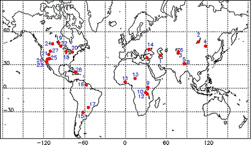
Figure 1 Distribution of the case study lakes and reservoirs (see Table 1).
*The removal of geographically correlated orbit error components via the use of repeat track techniques may reduce this value.
**Variable with surface roughness and target size.
*rms based on AMR (primary) or ECMWF (secondary), the GIM model, the sea state bias and the ocean-retracker range. All others based on the ECMWF and GIM models and the ice-retracker range.
**rms improves to 6.70 cm for the May to October summer period. Distance is the approximate separation of ground track and gauge site.