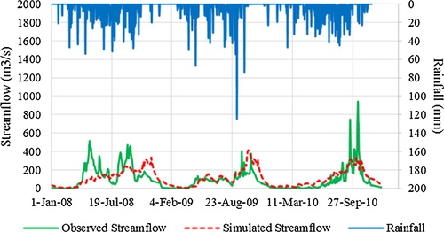
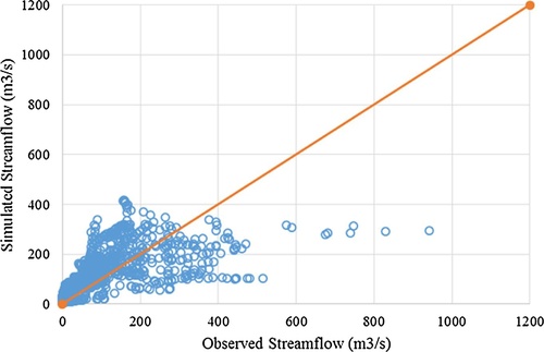
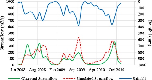
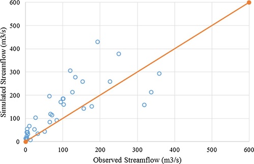
1,839
Views
38
CrossRef citations to date
0
Altmetric
Research Articles

Simulating streamflow in an ungauged catchment of Tonlesap Lake Basin in Cambodia using Soil and Water Assessment Tool (SWAT) model

&
Pages 89-101 | Received 29 Dec 2016, Accepted 24 Dec 2017, Published online: 03 May 2019

Figures & data

Fig. 1 Study area: Stung Pursat River Basin.
Fig. 2 Elevation map of Stung Pursat River Basin.
Fig. 3 Landuse map of Stung Pursat River Basin.
Fig. 4 Soil type map of Stung Pursat River Basin.

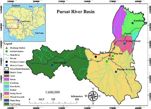
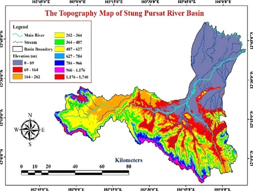
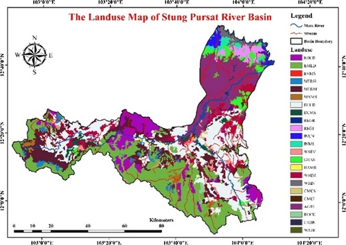
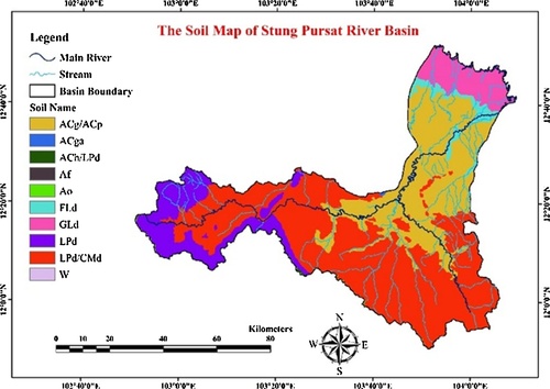
Table 1 The available input data for setting SWAT model.

Table 2 The selected parameters with initial parameter ranges put into SWAT-CUP program with SUFI-2 method for the parameter sensitivity analysis.

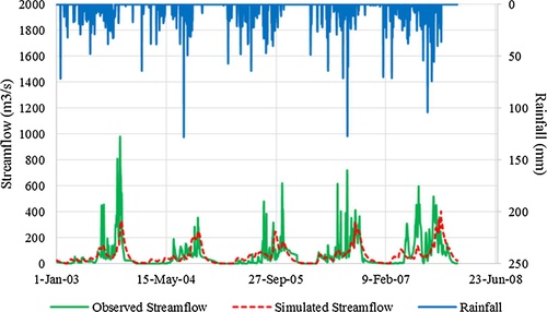
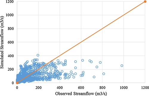
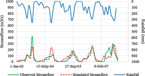
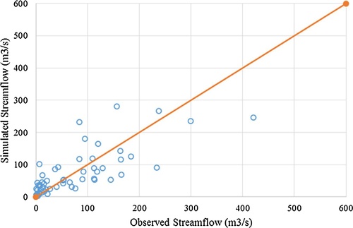
Table 3 Performance ratings of recommended statistics for streamflow simulation.

Table 4 Most sensitive parameters for stremflow simulation in Stung Pursat River Basin.

Table 5 Final auto-calibration result of fitted sensitive parameters.

Fig. 5 The hydrograph of daily simulated and observed flow for calibration period.
Fig. 6 Scatter plot of daily observed versus simulated streamflow for calibration period.
Fig. 7 The hydrograph of monthly simulated and observed flow for calibration period.
Fig. 8 Scatter plot of monthly observed versus simulated streamflow for calibration period.
Fig. 9 The hydrograph of daily simulated and observed flow for validation period.
Fig. 10 Scatter plot of daily observed versus simulated streamflow for validation period.
Fig. 11 The hydrograph of monthly simulated and observed flow for validation period.
Fig. 12 Scatter plot of monthly observed versus simulated streamflow for validation period.