Figures & data
Overall demographics and individual responses to entomological questions of surveyed children in the six communities in Loja province, Ecuador (EC)
Overall B. bacilliformis seropositivity in children by community and age group
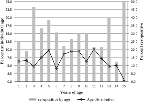
Fig. 1 Age curve of seropositivity showing the percentage of children at each age from total children in all six study communities in Loja Province compared to the percentage of seropositive children at each age. The left axis corresponds to the line graph denoting the percentage of children at each age. The right axis corresponds to the bar graph denoting the percentage of children at each age that are seropositive
Comparison of seropositive children between communities by post hoc pairwise testing using Fisher’s exact tests of independence
Household characteristics in the six study communities in Loja province
Univariate associations between B. bacilliformis seropositivity and select variables
Multivariate model 2 using logistic regression to determine associations between B. bacilliformis seropositivity including statistically significant variables from univariate analysis
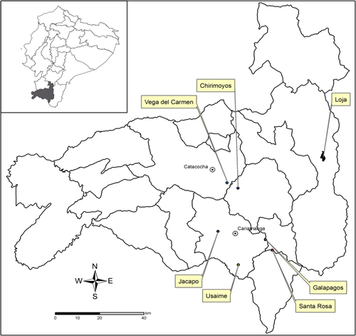
The six study communities are identified in the large map of Loja province. Also shown is the provincial capital city of Loja and major communities of Catacocha (Paltas County) and Cariamanga (Calvas County). WGS84 coordinates for each community are as follows: Chirimoyos (04.12972°S, 79.5456°W), Vega del Carmen (04.10610°S, 79.59012°W), Jacapo (04.36621°S, 79.4162°W), Usaime (04.46035°S, 79.54414°W), Santa Rosa (04.3960°S, 79.41861°W, and Galapagos (04.35233°S, 79.4344°W)