Figures & data
FIGURE 1. Location map.
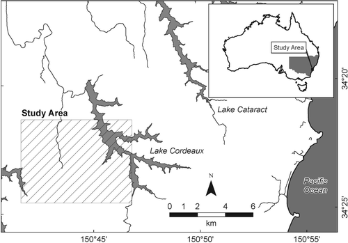
PLATE 1. Topography and sample plots. Hillshade solar angle 45°; azimuth 315°. See Jenkins (Citation2009) for additional field site data.
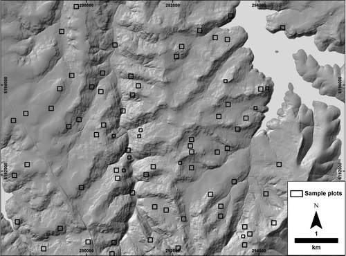
TABLE 1. Plot means, standard error and ANOVA significance α<0.05
TABLE 2. Between-plot correlation of QuickBird NDVI vs ALS-derived metrics. The lack of correlation overall shows the lack of redundancy between different metrical and sensor types
FIGURE 2. Semivariance range plots for ALS height data. Semivariance range (vertical axis) for a series of lag widths (horizontal axis) for selected field sites. The range typically plateaus at a certain lag width, which indicates the size of dominant features within the field sites. Distances in metres. Site A1_001 was outside the area of landscape stratification. See Jenkins (Citation2009) for additional site details.
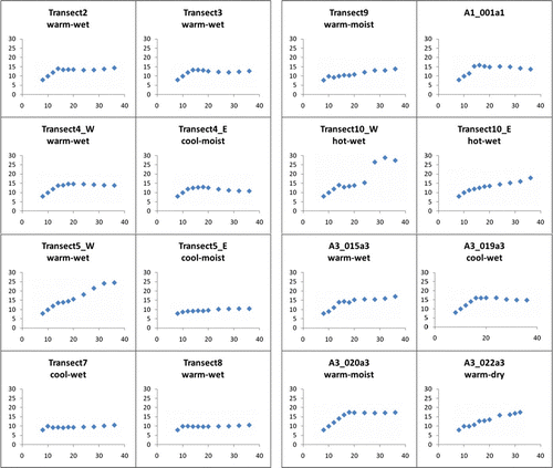
TABLE 3. Correlation of NDVI vs CHM semivariance ranges. The lack of correlation overall shows the lack of redundancy between different metrical and sensor types
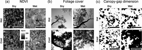
PLATE 2. Vegetation responses to energy and water availability (scale bar 50 m). Representative illustrations from sample plots (a) NDVI increases with increasing water; (b) foliage cover decreases with increasing energy (field photographs); (c) canopy-gap dimension increases with increasing water (from CHM 10 m stratification).