Figures & data
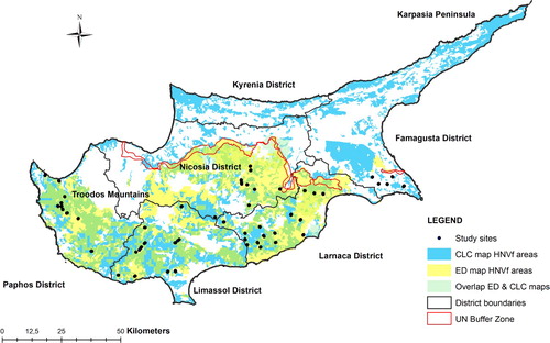
Figure 1. Map of Cyprus showing the location of the 47 study sites and the areas identified as High Nature Value farmland (HNVf) under the CORINE land cover-based map (‘CLC map’) and the Cyprus Environment Department map (‘ED map’), as well as the overlap between these two maps (‘Overlap ED & CLC maps’).