Figures & data
Figure 1. Data hierarchy. Original forms, variant forms, lemma forms, and standard forms in the Norse Perception of the World project data.
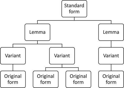
Figure 2. Data clustering in the Norse World interactive map including a close-up of the Paris area © 2019 Norse World, © Leaflet, © OpenStreetMap, © CartoDB. The figures in the map represent aggregations of attestation frequencies, i.e. how often clusters of spatial references or individual spatial references (e.g. Paris) are attested in the East Norse corpus.

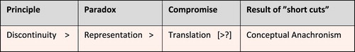
Figure 3. Paradox of representation leading to conceptual anachronism, adapted after Poe (Citation1996: 354 Table 3): Scientific Programs and Anachronism.