Figures & data
Figure 1. Location map for St John's in eastern Newfoundland, Atlantic Canada. The oldest parts of the city are located in the downtown area, on the north side of St John's Harbour.
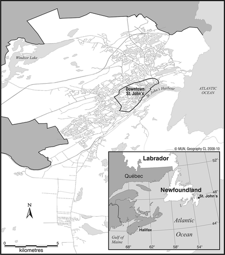
Table 1. Details of blood lead studies conducted in Canada
Table 2. Comparisons of soil lead concentrations for Canadian cities. The data for St John's are from this study
Figure 2. (a) View looking west across downtown St John's c. 1920s. The harbour is visible on the far left. The downtown was (and remains) predominantly residential, comprised of clapboarded, wooden-framed row houses with small rear gardens. The paint regularly applied to clapboard contained lead. Coal was a common heating fuel for much of the 1800s through to the 1950s and contained high lead and arsenic levels. (b) View looking west across downtown St John's soon after the fire of 1892. Photographer's position is slightly to the left (south) of the one in . Only stone and brick structures survived the fire. Note the two towers of The Basilica Cathedral of St John the Baptist in the right background. They are also visible on the far right in . Source: The Geography Collection, Archives and Manuscripts Division, Memorial University of Newfoundland, St John's.
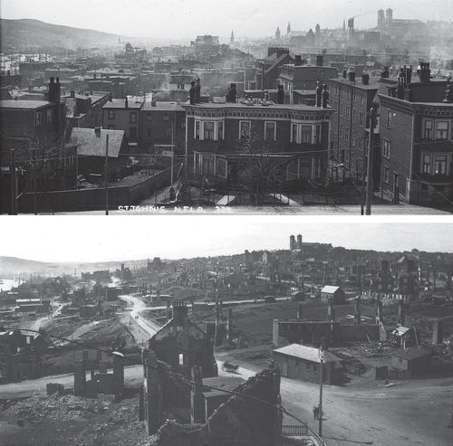
Table 3. Summary statistics on lead concentrations (ppm) in soil samples from surface and sub-surface levels in rural and suburban (non-urban) settings around St John's. Sub-surface samples are further divided by the geological group underlying the sample location
Table 4. Descriptive statistics for soil lead concentrations by sample category for St John's
Figure 3. The percentage distribution of soil samples by sample type in each of four soil lead concentration categories defined by Canadian and US recommended guidelines: CCME residential guideline (140 ppm), US EPA guideline for bare soil in play areas (400 ppm), and US EPA bare soil outside play areas (1200 ppm).
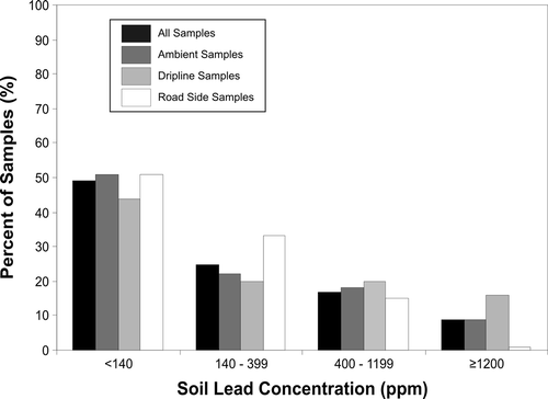
Figure 4. Spatial distribution of soil lead concentrations by sample location for (a) all samples and (b) dripline samples only. Mapped categories are defined by Canadian and US recommended soil lead concentrations. The high density of soil samples in the downtown area causes overlapping of category symbols and obscuring of samples with higher lead concentrations in (a). These high-soil-lead locations are predominantly associated with dripline samples and are more clearly visible in (b).
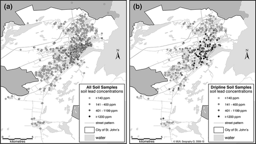
Figure 5. The distribution of GM soil lead concentrations by sample type for each of six property age categories for St John's.
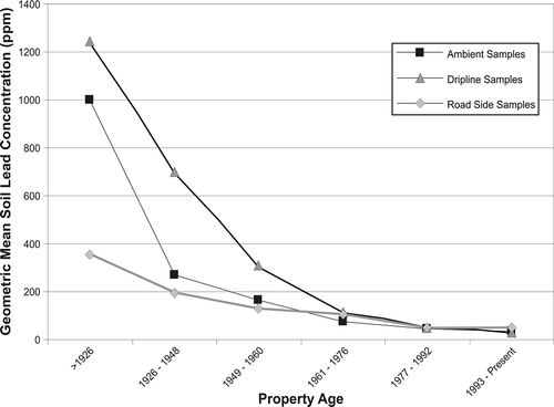
Figure 6. The percentage distribution of soil samples by sample type in each of four soil lead c-oncentration categories defined by Canadian and US recommended guidelines grouped by property age.
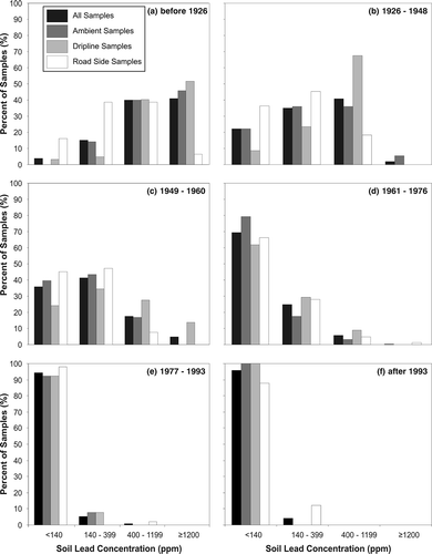
Table 5. Descriptive statistics for indoor lead loadings by dust sample location. All values in μg/ft2 for comparison with US EPA guidelines for indoor dust levels
Figure 7. The distribution of GM dust lead loadings by sample location for each of six property age categories for St John's.
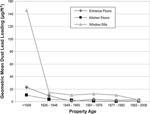
Figure 8. Log-log plot of GM soil lead concentration and dust lead loading by sample location on sampled properties in St John's.
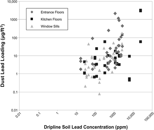
Table 6. Comparisons of soil lead concentrations (ppm) in three different locations on properties in New Orleans and St John's
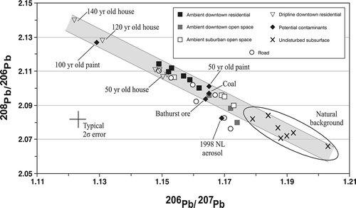
Figure 9. Lead isotope composition of contaminated urban soils, undisturbed background samples (C-horizon tills), and potential contaminants (coal, paint chips, ore, and atmospheric aerosol). Soil samples from open spaces and yards are equivalent to ambient samples.