Figures & data
Figure 1 Changes in mean percentage cover and species richness for all species, vascular species and non-vascular species in the 15 years after fire in Dracophyllum subulatum frost flat heathland at Rangitaiki. (A) Change in mean percentage cover (± 1 SE). (B) Change in mean species richness (± 1 SE).
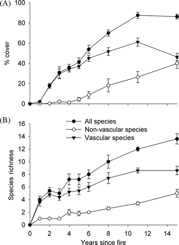
Table 1 Mean per cent cover by species over the 15 years after a natural fire in Dracophyllum subulatum frost flat heathland at Rangitaiki.
Figure 2 Compositional changes in the 15 years after fire in Dracophyllum subulatum frost flat heathland at Rangitaiki, summarized using non-metric multidimensional scaling (NMS) ordination. The optimal NMS solution had two axes and we calculated the mean axis 1 and 2 plot scores (± 1 SE) for each year since burning and for lichenfield (~ 25 years) and shrubland (~ 80 years) and plotted these to illustrate the successional trajectory. We overlaid selected species scores (centroids) from the ordination to highlight the position of key species during the succession. Mean plot scores for each year after fire and for the two older communities are labelled. Lichenfield and shrubland data are from Smale (Citation1990).
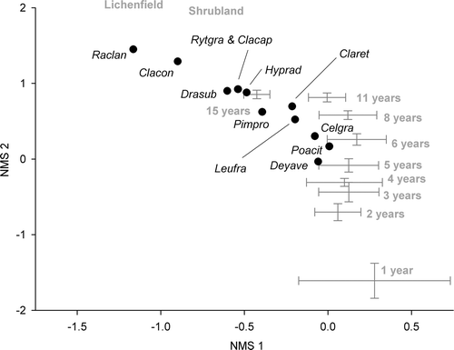
Figure 3 Density of Dracophyllum subulatum (stems ha−1) over the 15 years after a natural fire in frost flat heathland at Rangitaiki. Values for ~ 25 and ~ 80 years are from Smale (Citation1990); the value for 100 years is the measured preburn density.
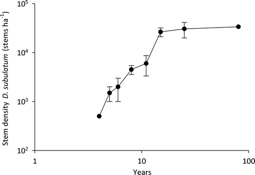
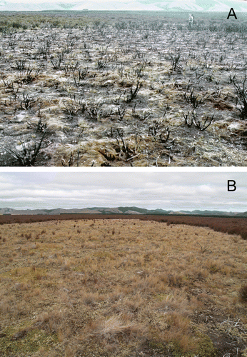
Figure 4 Frost flatheathland burnt by a lightning-induced natural fire at Rangitaiki, central North Island, New Zealand. A, March 1995, one year after fire; loamfield. B, March 2009, 15 years after fire; lichenfield dominated by Cladia retipora.