Figures & data
Figure 1 Auckland Islands showing the main breeding islands for NZ sea lions: Enderby, Dundas and Figure of Eight. Inset: New Zealand's sub-Antarctic area.
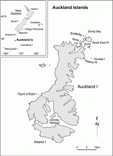
Figure 2 Frequency distribution of mean percentage of dives in each depth category for eight female NZ sea lions, winter foraging.
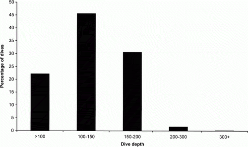
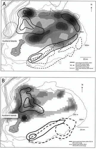
Figure 3 Kernel range of all filtered satellite locations for lactating NZ sea lions from: A, Enderby Island, July to September 1996–1997 (n=6) and B, Enderby Island, January and February 2001–2004 (n = 26). Intensity of shading of kernel ranges represents percentage of time spent in the area displayed as highest concentration of locations (darkest) to lowest concentration (lightest). Bathymetric contours are shown as thin black lines, with the Auckland Islands shelf represented by the 500 m bathymetric boundary. Arrow squid Nototodarus sloanii trawl fishery effort (50% and 95% kernel ranges) from: A, January to April 1996–1997 and B, February to April 2001–2007 are represented by thick black solid lines. Scampi Metanephrops challengeri trawl fishery effort (50% and 95% kernel ranges): A, all year 1996–1997 and B, all year 2001–2007 are represented by dashed black lines. A, all other trawl fisheries activities (50% and 95% kernel ranges), all year 1996–1997 are represented by dotted black lines.