
Figures & data
Figure 1. Map of the Bay of Plenty showing the location of the MV Rena on Otaiti (Astrolabe Reef), Mōtītī Island and Tauranga.
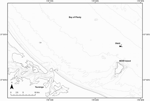
Figure 2. Outer reef (OR1–3) and debris field (DF1–3) sampling sites (grey ovals) on Otaiti (Astrolabe Reef) where DGTs were deployed and water samples collected. The approximate position of the bow and stern sections of the Rena are indicated in grey. A dashed line indicates the area designated in June 2013 as the main Rena debris field.
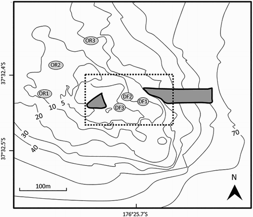
Figure 3. A, cross section of a standard open pore DGT sampler (Chelex-100 resin; 0.4 mm thick; 0.45 µm cellulose nitrate membrane filter); B, triangular polymethyl methacrylate DGT housing unit cable tied to a 10 kg vinyl plate.
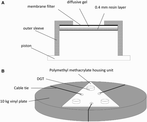
Table 1. Total solution concentrations (nmol kg−1) of trace metals for sites within the debris field, outer reef and Mōtītī Island sampling areas.
Figure 4. Two-dimensional PCO ordination of DGT data from sampling sites in the Otaiti debris field (●), Otaiti outer reef (○) and Mōtītī Island (*). Principal component axis 1 (PCO1) accounts for 43.1% and axis 2 (PCO2) 17.7% of total variance in the data.
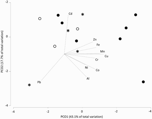
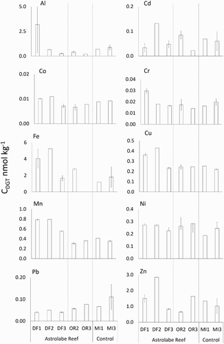
Figure 5. DGT-available metal concentrations (CDGT) ± SE (nmol kg−1) for the three sampling areas ( and ); debris field (DF), outer reef (OR) and Mōtītī Island (MI).