Figures & data
Figure 1. Fish survey streams and water quality monitoring sites within the Ngakawau, Mohikinui and Waimangaroa rivers. The Stockton mine and major waterways are shown along with the location of long-term water quality monitoring stations. Ngakawau sites devoid of fish are marked with an X. AMD discharges to to the Ngakawau River are labelled and the extent of the Ngakawau Gorge is highlighted.
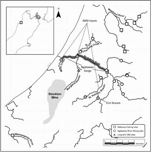
Figure 2. Water pH recorded in the Mangatini Stream and lower Ngakawau River between 2006–2012. The vertical black line indicates the start date of limestone dosing.
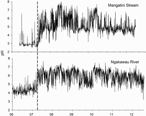
Figure 3. Dissolved Al (mg/L) concentrations in the Mangatini Stream and Ngakawau River. The vertical black line indicates the start date of limestone dosing.
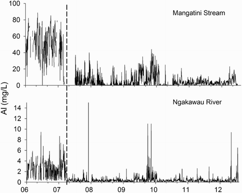
Figure 4. Turbidity (NTU) in the Mangatini Stream and Ngakawau River. The vertical dashed black line indicates the start date of limestone dosing, while instalment of the Mangatini sump is indicated by the dotted line.
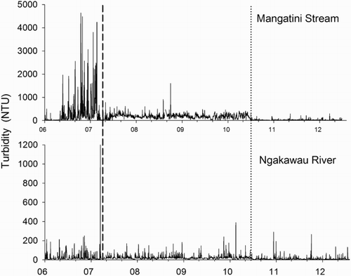
Table 1. Comparison of water quality at reference sites and within the Ngakawau River system in 2005 and 2011–2012.
Figure 5. The standard error of the mean (±1 SEM) density of kōaro at sites within and adjacent to the Ngakawau River system in 2005 and 2012. Significant (P < 0.05) differences between groups derived from within treatment pairwise t-tests are indicated by letters.
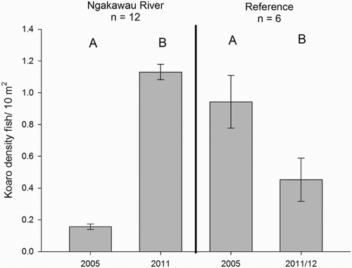
Table 2. Repeated measures ANOVA of kōaro density at sites within and adjacent to the Ngakawau River system in 2005 and 2012.
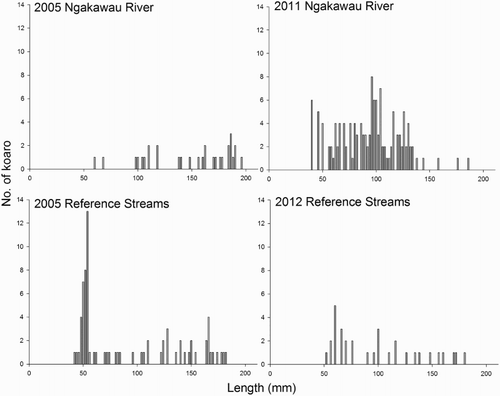
Figure 6. Length frequency distributions of kōaro within and adjacent to the Ngakawau River system in 2005 and 2011–2012.