Figures & data
Figure 1. Map of the Auckland Islands showing the study area in and around Port Ross. Inset shows the the location of the Auckland Islands relative to mainland New Zealand.
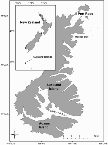
Figure 2. Distribution of calving intervals observed after 8 years (2006–2013) of data collection in Port Ross, Auckland Islands, New Zealand. Total sample size (n = 45).
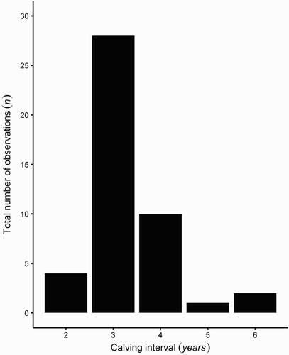
Figure 3. Density distributions of the 1000 resampled mean calving intervals for the range of sample sizes tested (n = 10, 100, 500, 1000, 2000).
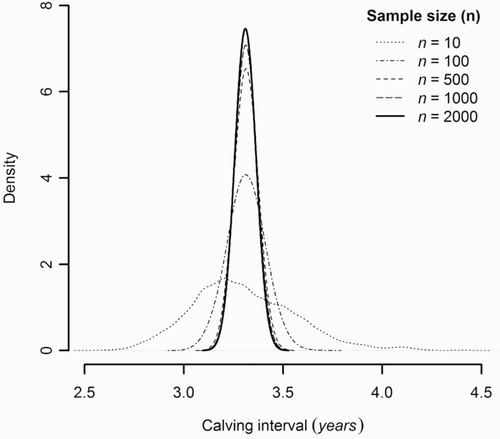
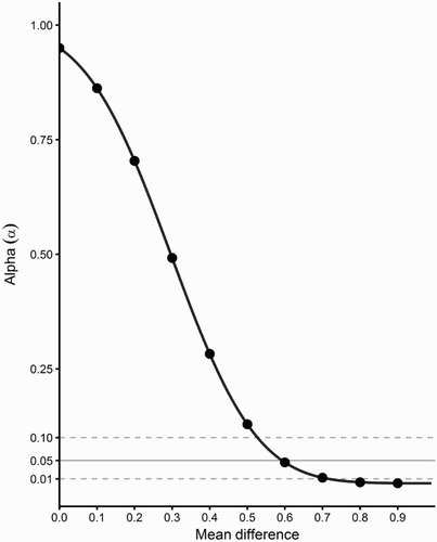
Figure 4. Power analysis showing the change in alpha on the y-axis as the difference of the mean estimate increases on the x-axis with sample size of 45 calving intervals.