Figures & data
Table 1. Selected map and/or coordinate-relevant competence objectives from the core curriculum (Knowledge Promotion Reform) (Utdanningsdirektoratet 2006)
Table 2. Seven different competencies associated with the student project, using a three-point distribution of competence levels and competence requirements in accordance with Isnes's (2007) taxonomy (knowledge ladder, based on Bloom's (1956) taxonomy) used in curriculum work; ‘x’ indicates which competence level the students had reached
Fig. 1. Screen dump of the results from one of the groups that had recorded the most waypoints (after being motivated by the promise of a reward)
Note the cluster of points in the lower right corner of the map. Image reproduced with the kind permission of Garmin.
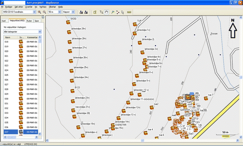
Fig. 2. Screen dump of a map showing possible sites for nesting boxes, obtained from a hand-held GPS receiver. Image reproduced with the kind permission of Garmin.
