Figures & data
Fig. 1. The study area defined on the basis of SRTM data, GALPIS, and EuroGeographics; the German language boundary shows the extent of the main language used in c.1900 in relation to present-day municipalities’ boundaries; former German-language ‘islands’ outside the Alpine Convention area are not included
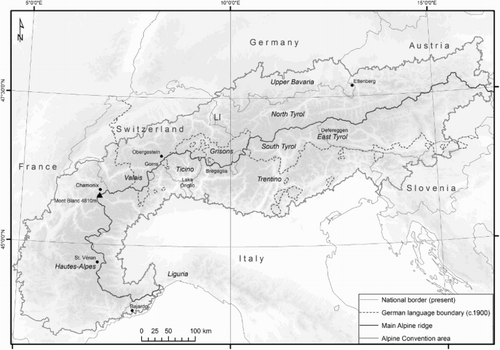
Fig. 2. Settlements in the southern and northern Alps: a) Bajardo (Liguria, Italy), 900 m a.s.l., a cluster village with terraced, small strip plots and mixed farming, with emphasis on arable farming (Photo: Oliver Bender, 1996); b) Ettenberg (Bavaria, Germany), 900 m a.s.l., a dispersed settlement with block plots and ‘meadows-pasture’ farms, with emphasis on livestock farming (Photo: Oliver Bender, 2004)
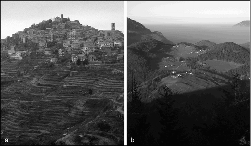
Table 1. Different traditional settlement and agrarian systems in the Alps during the agrarian age (Source: Bätzing Citation2003)
Fig. 3. Sweet chestnut culture: a) orchard in Bregaglia Municipality (Grisons, Switzerland) (Photo: Oliver Bender, 2001); b) simplified pollen diagram for Lake Origlio (Ticino), 420 m a.s.l.
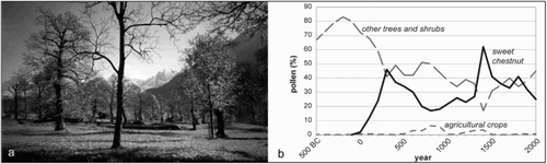
Table 2. Source and destination regions of migration to and from Alpine areas as a percentage of the total in-migration and outmigration in the period 2002–2011 (France: 2003–2008; Slovenia: 2008–2012)
Fig. 4. Demographic types of mobility into the Alps by permanence of stay (based on Zelinsky Citation1971, with modifications based on Bender & Kanitscheider Citation2012)
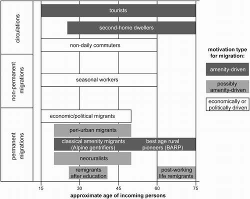
Fig. 5. Neoruralist and abandoned areas: a) some new fields cultivated by neoruralists on formerly abandoned terraces in St. Véran (Hautes-Alpes, France), 2040 m a.s.l.; b) some of the very few remaining fields in Obergesteln (Valais, Switzerland), 1355 m a.s.l. (Photos: Oliver Bender, 2008)
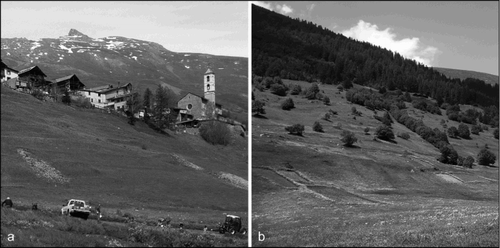
Fig. 6. Migration balance in East Tyrol in the period 1996–2010; summarized migration balance (upper image); migration balance for the age cohort 50–74 years (lower image); (Source: Statistics Austria; Data: Migration Statistics 1996–2010)
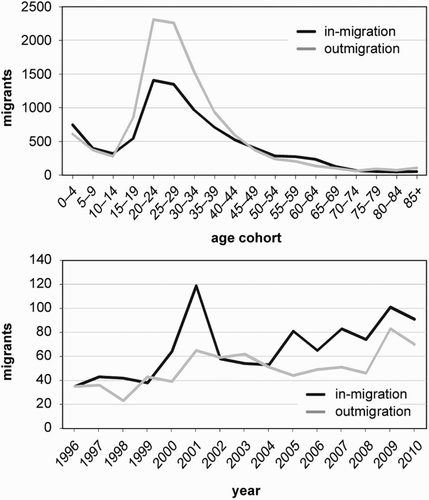
Fig. 7. Model of distribution of inhabitants in Alpine valleys: a) valley without mass tourism (modified from Steinicke et al. Citation2012, 335); b) northern Alpine valley with mass tourism
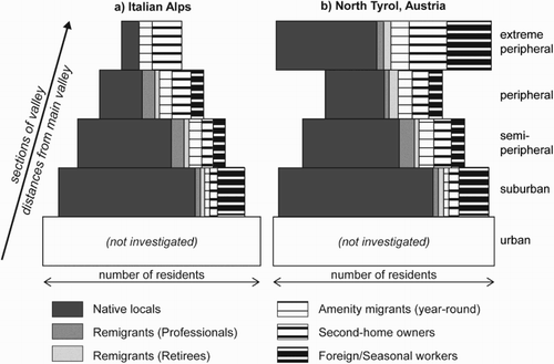
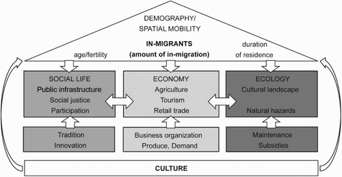
Fig. 8. Spatial population mobility, landscape, and cultural sustainability in Alpine communities