Figures & data
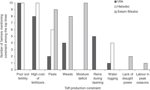
Figure 1. Map of Ethiopia with the three study sites. The major areas with Vertisols are in grey (FAO et al. 1998). Note that Vertisols in the Hatsebo study site are not in what is considered a main Vertisol area but have been studied and considered true Vertisols (Gebretsadikan et al. Citation2009).
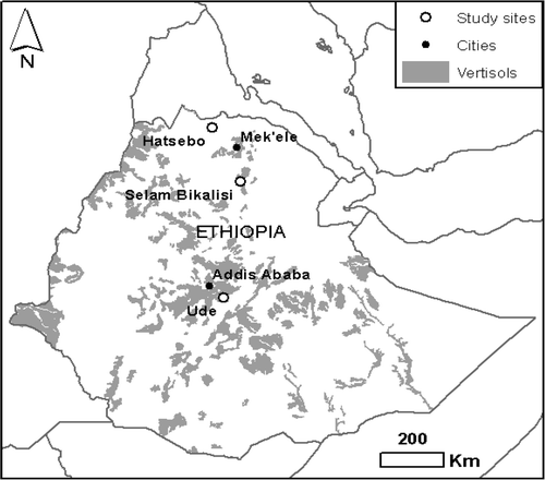
Figure 2. Average monthly rainfall (solid lines and squares), actual monthly rainfall in 2008 (bars) and estimated potential evapotranspiration (dashed lines and triangles) for (a) Ude, (b) Hatsebo, and (c) Selam Bikalisi. Arrows indicate teff sowing (solid) and harvest (dashed) in 2008.
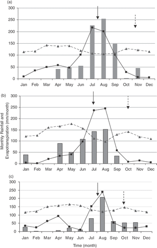
Table 1. Description of the study sites
Table 2. Soil properties of teff fields on Vertisols from the participating farmers
Table 3. Summary description of farming systems as provided by the participating farmers at the three sites (n = 10 per site)
Figure 3. Initial individual farmers’ identification of teff production constraints at the three investigated sites.