
Figures & data
Figure 1 Diagram of a closed cell for dissolved oxygen (DO) measurement. PVC, polyvinyl chloride.
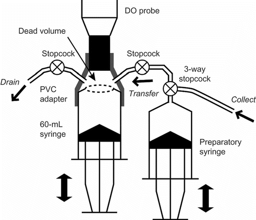
Figure 2 Seasonal changes in precipitation (vertical bars) and water table level at each site (lines with symbols).
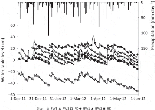
Table 1 Environmental factors at all study sites averaged for the observation period
Figure 3 Seasonal variations in the fluxes of (a) methane (CH4), (b) carbon dioxide (CO2) and (c) nitrous oxide (N2O) at the ground surface. Error bars show standard deviations.
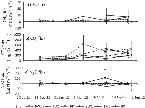
Figure 4 Relationship between water table level and the fluxes of (a) methane (CH4), (b) carbon dioxide (CO2) and (c) nitrous oxide (N2O), averaged for the observation period. Error bars show standard deviations.
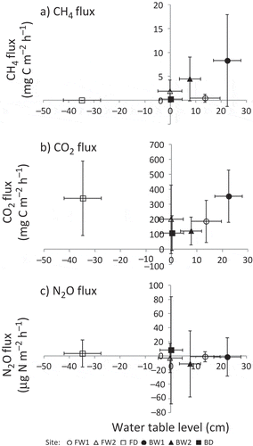
Table 2 Comparison of greenhouse gas (GHG) fluxes among different land use and drainage conditions.
Figure 5 Vertical distribution in dissolved concentrations of (a) methane (CH4), (b) carbon dioxide (CO2), (c) nitrous oxide (N2O) and (d) dissolved oxygen (DO), averaged for each depth. Soil temperature preliminarily observed in 2011 was plotted with dissolved CO2 (b). Error bars show standard deviations. For better identifiability, the depths in the profiles were slightly shifted from their actual depths (20, 40, 60 and 80 cm for CH4, CO2 and N2O; 10, 20, 40 and 80 cm for DO; 5, 10, 30 and 50 cm for soil temperature).
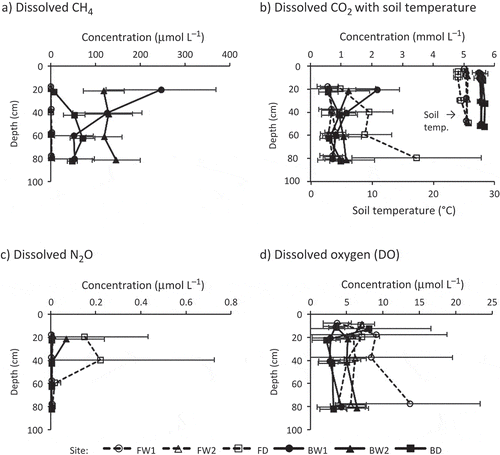
Table 3 Results of three-way analysis of variance (ANOVA) on dissolved gas concentrations among different land use, drainage and depth