
Figures & data
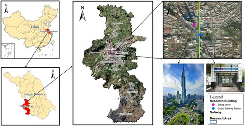
1 Map and photos of the experimental area
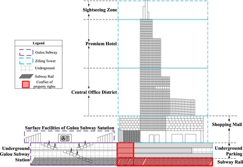
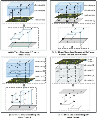
2 Profile showing the structural relationship between GSS and ZFT (ZFT)
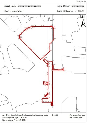
3 Cadastral map of NG-CBD
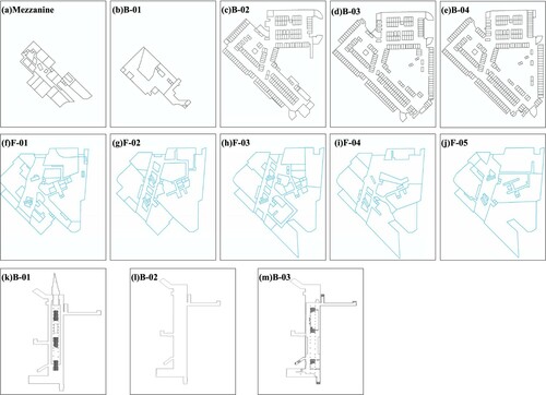
4 Floor plan map from the survey of ZFT and GSS
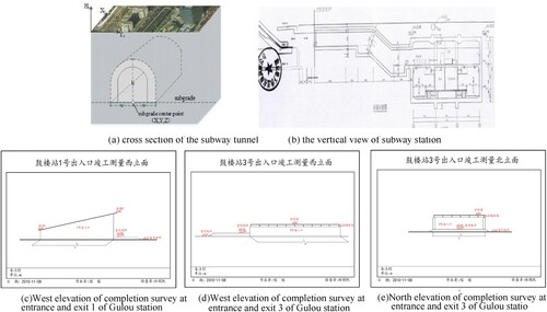
5 Schematic diagram of the subway tunnel and station
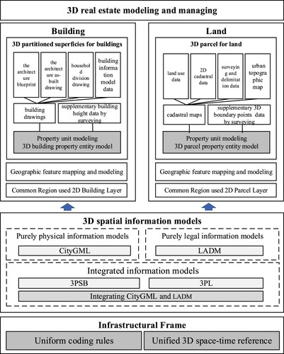
6 Flow chart of SIM-3RE modeling
7 Surveying and modeling for the boundary points of 3RE
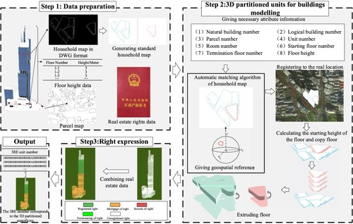
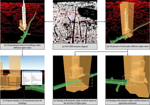
8 Flow chart for the modeling of 3D partitioned units for buildings
9 Simulation of SIM-3RE on the right expression of 3RE
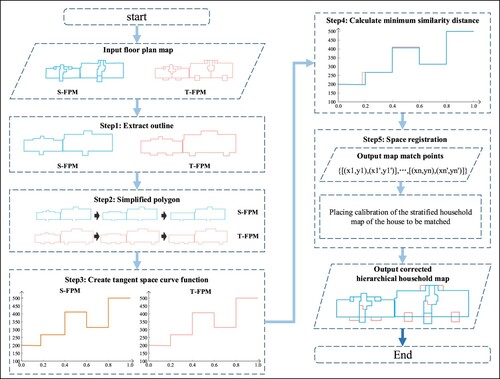
10 Algorithm flow chart of FSRA-TSC
Data availability statement
All data used during the study were provided by a third party, Nanjing Urban Planning and Natural Resources Bureau. Direct requests for these data must be made to the provider as indicated in the Acknowledgments. The confidential data include cadastral map of the NG-CBD region, floor plan map of ZFT, as-built drawings and construction completion report. So these data cannot be shared at this time.