Figures & data
Figure 1. Fire pit line from Roskilde, Denmark, looking southwest. Photograph reproduced with the permission of Roskilde Museum.
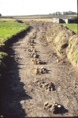
Figure 2. Distribution map of (fire) pit alignments known from northern Europe, including Britain, the Netherlands, Germany, Denmark and Sweden. The features vary in date, from the Late Neolithic to the Early Iron Age. Based on Heidelk-Schacht (Citation1989), Lütjens (Citation1999) and Kristensen (Citation2008) with additions.
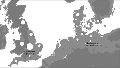
Figure 3. Fire pit line at Brokbakken III, Denmark (Kristensen Citation2008, Figure 13).
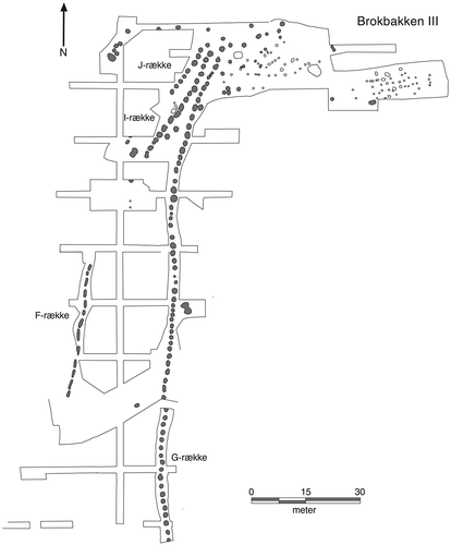
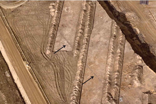
Figure 4. Pit line at Seddin, Germany (Brunke et al. Citation2016, Figure 12). Scale in metres.
Figure 5. Fire pit line from Apeldoorn, the Netherlands (Louwen and Fontijn Citation2019).
Figure 6. Pit alignment discovered in Zwenkau, Germany, looking north (Landesamt für Archäologie Sachsen). Each pit is on average c.5 metres long.