Figures & data
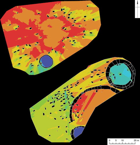
Figure 1. Visual entropy plot of the early medieval cemetery of West Heslerton, showing (in online colour version only) the most ‘open’ areas in red to most constrained in blue. A large open area in the north of the site is likely to represent the location of an early medieval barrow raised over the high-status male (grave 52) in potential imitation of the three Bronze Age barrows in the centre, far south and east of the cemetery. These also provide a focus for early medieval burial. Burials within the large hengiform enclosure are physically segregated from other graves, and it may be significant that several of the cremation burials from the cemetery are located here. Analysis and diagrammatic representation by Stuart Brookes and Brian Buchanan based on data published in Haughton, Powlesland, and Blades (Citation1999) (Brookes et al. Citationforthcoming).