Figures & data
Figure 1. Map showing extent of Sunda and Sahul continental shelves (light grey) boardered by Lydekker’s line to the east and Wallace’s and Huxley’s lines to the west. The islands of Wallacea as per Wallace’s line are shown in dark green, while the Philippine islands included under Huxley’s modification to Wallace’s line are shown in light green.
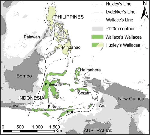
Figure 2. Terminal Pleistocene obsidian networks in Wallacea. a) The southern Wallacean ‘Group 1’ network incorporating the islands of Alor, Atauro, Timor, and Kisar. Graph inset from Reepmeyer et al. (Citation2019: fig. 6), photo inset from Maloney et al. (Citation2018): ). b) The Philippine island network incorporating the islands of Palawan and Ilin (Mindoro). Photo inset from Neri et al. (Citation2015):). The dotted line indicates possible extent of the networks.
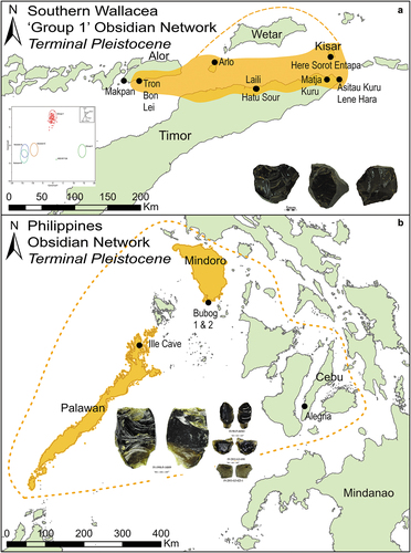
Figure 3. Shell fish hook network incorporating the islands of Alor, Timor, and Kisar during the terminal Pleistocene. Photo insets for jabbing hooks from Langley et al. (Citation2021: fig. 8) and O’Connor et al. (Citation2019: fig 7), and rotating hooks from O’Connor et al. (Citation2017b: fig. 7).
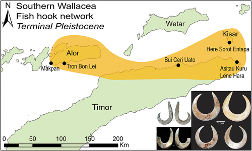
Figure 4. Shell adze network of Wallacea and Oceania from the terminal Pleistocene to early Holocene. Incorporating the islands of Ilin (Mindoro), Merampit (Talaud), Gebe, Obi, Sanana (Sula), Timor, and Manus. Dotted line shows possible extent of this network. Photo insets of ground shell flakes from Shipton et al. (Citation2020b: fig. 12) and whole shell adze from Shipton et al. (Citation2020a: fig. 9).
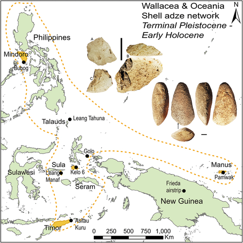
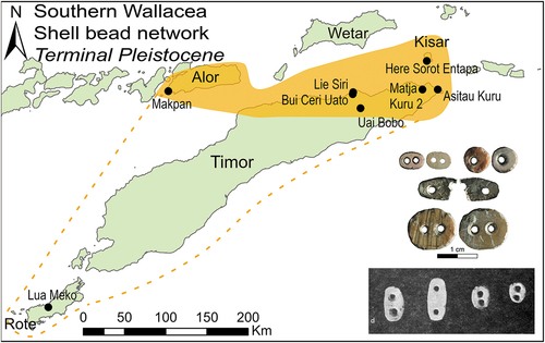
Figure 5. Double-holed appliqué bead network of southern Wallacea incorporating the islands of Alor, Timor, and Kisar. Dotted line shows possible extension of this network. Photo insets: colour from Kealy et al. (Citation2020: fig. 12), black and white from Glover (Citation1986: plate 32).