Figures & data
Fig 1 Topographic map showing the location of areas and sites mentioned in the text. Map by author.
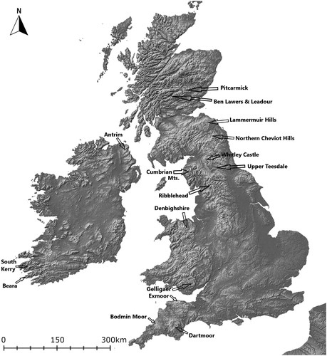
Fig 2 SW-facing view of abandoned post-medieval booley dwelling in Coolagarranroe, Galtee Mountains (Co Tipperary, Ireland), showing grassier vegetation and absence of heather. Photograph by author.
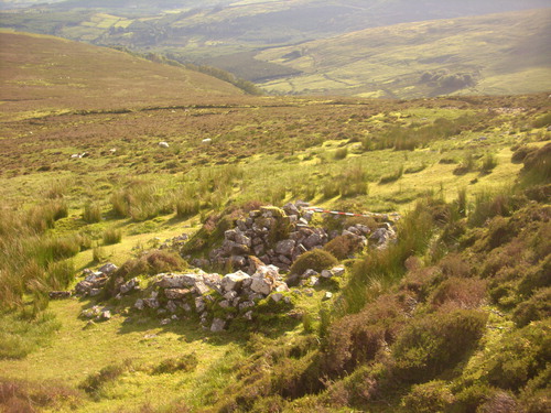
Fig 3 NW-facing view of abandoned post-medieval booley site in Mín na Saileach (Co Donegal, Ireland), with heavy colonisation by bracken. Photograph by author.
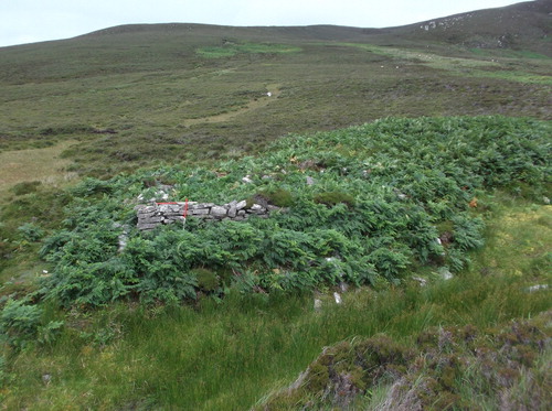
Fig 4 Illustration of the ‘pull’ and ‘push’ factors in upland colonisation in the 10th to 14th centuries, in the context of wider climate variability: A) local factors within uplands which acted as facilitative ‘pull’ factors for new hill farms; B) regional socio-political and demographic pressures which acted as ‘push’ factors for people to settle in uplands. Climate shifts which led to more favourable precipitation levels and soil temperatures increased the likelihood of these pull/push factors being acted upon. Drawing by author.
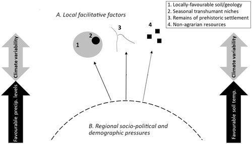
Fig 5 Plan of excavated early medieval hill farms in Brows Pasture, Ribblehead. Taken from Johnson Citation2015, fig 3, reproduced by kind permission of Dr David Johnson.
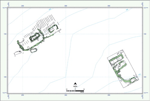
Fig 6 Preliminary map of previously unrecorded archaeological features surviving upslope of an in-use hill farm in Cloon West (Co Kerry, Ireland). Red dots mark hut sites, and black lines mark relict walls. Map by author, satellite image data by Google Earth, Maxar Technologies.
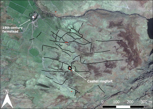
Fig 7 NW-facing view of test trenching in Coolnagoppoge (Co Kerry, Ireland) (see Murphy and Costello Citation2019; excavation license: 16E0127). The site is in an area of hilly blanket bog (c 290 m ASL) which was colonised by tenant farmers in the late 18th or early 19th century. The section consists of, from top to bottom: (1) a greyish-brown sandy silty clay likely created by farmers with burnt lime, livestock dung and sand from nearby streambeds, (2) a very thin iron pan, and (3) a buried dark-brown peat layer which pre-dates the colonisation. Photograph by author.
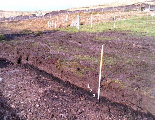
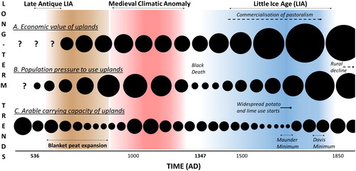
Fig 8 Hypothetical summary of three key long-term trends that influenced decisions to establish year-round farms in uplands and influenced the viability of these farms once established (c ad 500–1900): A) the economic value of uplands; B) population pressure to settle in uplands; and C) arable carrying capacity of uplands. Circle sizes are estimations of the relative strength of each influencing factor at a particular point in time; ie the larger the circle, the greater the economic value, population pressure to settle, or arable carrying capacity of uplands. Drawing by author.