Figures & data
Figure 1. Map showing interventions carried out by the Comparative Kingship Project in Scotland (2017–2020).
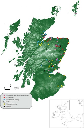
Figure 2. Simplified database model showing data tables and relationships.
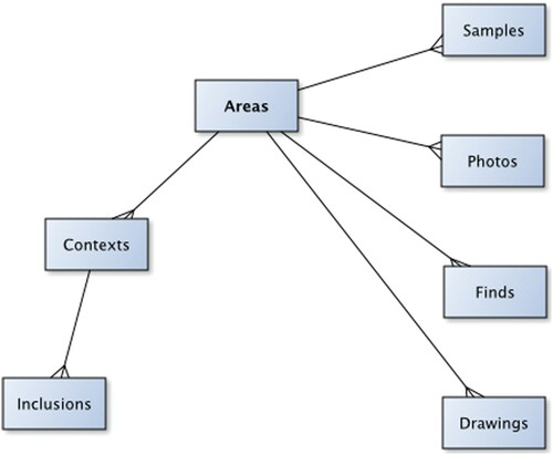
Figure 3. Excavation “Area” data page showing the “Context” list tab. Green numbers indicate the context data entry has been approved by a supervisor. The pencil button takes the user to the relevant recording form type (deposit/fill or cut).
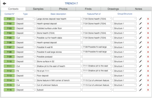
Figure 4. A) Context forms for recording deposits/fills and B) cuts, showing the combined use of text entry, graphics, and help prompts.
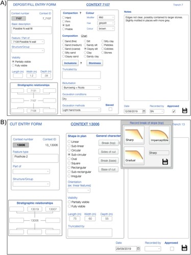
Figure 5. Photo register with preview.
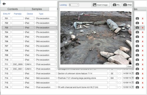
Figure 6. The digital recording workflow developed for the Comparative Kingship Project.
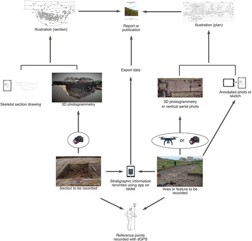
Figure 7. Site plan generated from single vertical drone shot. A) Aerial photograph of Lower Citadel trench, Burghead; B) digitally annotated photograph during excavation on tablet; C) final site plan.
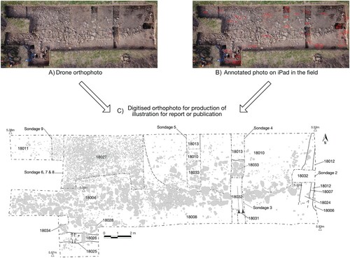
Figure 8. Aerial photogrammetry workflow.
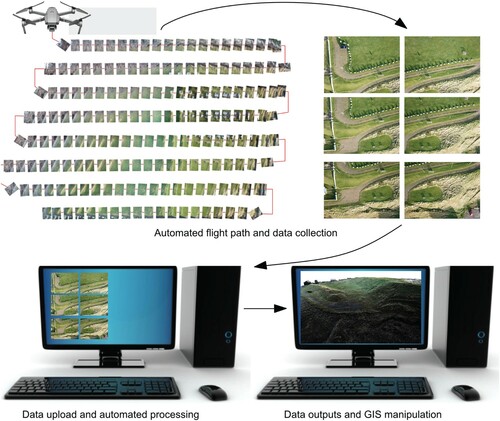
Figure 9. Aerial view of the Burghead site today and location of excavation trenches at the site.
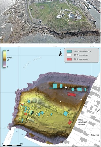
Figure 10. A) Comparison of orthophoto and photogrammetry model and B) comparison of photogrammetric models.
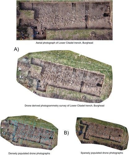
Figure 11. A) Comparison of hand-drawn vs. photogrammetry derived section drawings at Burghead. B) Section produced from combining photogrammetric model and hand-drawn outline of section at Balbinny, Angus.
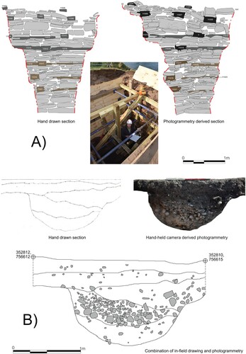
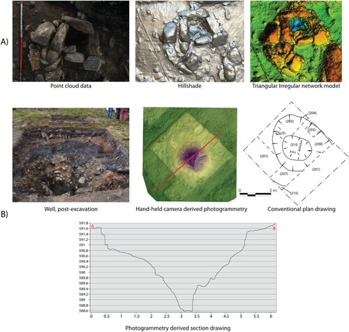
Figure 12. A) Photogrammetric models of a post pad at Burghead. B) Photogrammetry of the well at Tap O’Noth and generated profile.