Figures & data
Figure 1. Map of the study area in the Bolivian Amazon along the Beni River (Source: Authors, Data: SERNAP, Bolivia).
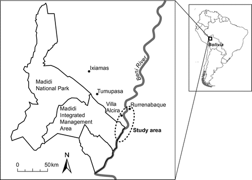
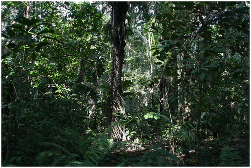
Figure 2. Typical example of the monte alto ethnoecological landscape category.
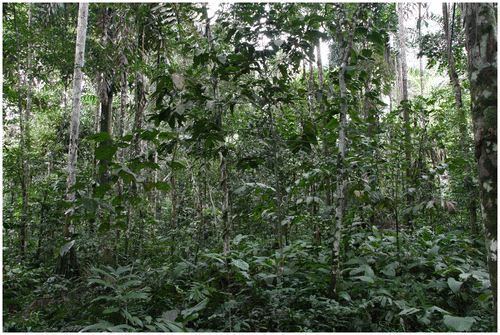
Table 1. Categories for monte alto (rainforest).
Figure 3. A jatatal is an important harvesting site for jatata (Geonoma deversa).
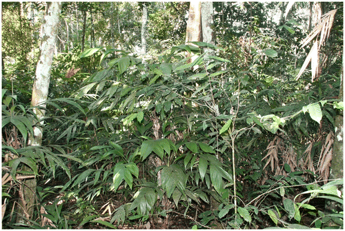
Table 2. Categories for chacos (agricultural areas).
Table 3. Categories for barbechos (fallow plots).
Table 4. Categories for orillas (riverbanks).
Table 5. Categories for ríos (rivers).
Table 6. Examples of ethnoecological vegetation categories (this study) and scientific botanical classification of vegetation units based on Fuentes (Citation2005).
Figure 4. Different scientific botanical categories by Fuentes (Citation2005) all referred to as monte alto in the ethnoecological landscape categorisation.
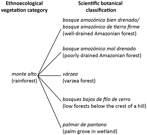
Figure 5. Different ethnoecological categories all referred to as riverine Amazonian forest in the scientific botanical categorisation by Fuentes (Citation2005).
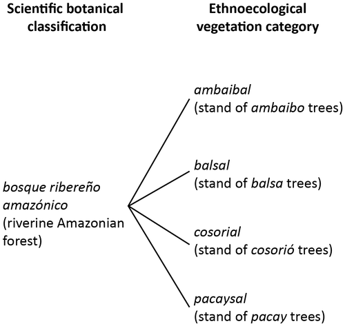
Figure 6. Landscape unit identified as a barbecho (fallow field) in the ethnoecological landscape categorisation.