Figures & data
Figure 1. Drawing by Albrecht Dürer (1471–1582) illustrating a technique for constructing perspective using Euclidean, geometrical forms, notably a grid resembling a map’s graticule, to construct the illusion of three dimensional organic bodily forms.
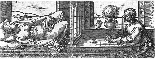
Figure 2. This Swedish banknote illustrates how the lines on the map, and the lines of perspective, structure the space of landscape scenery. These lines would normally be invisible, but here they have been materialised as enclosed property boundaries. (Colour figure available online).
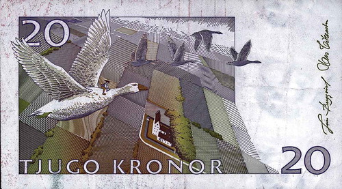
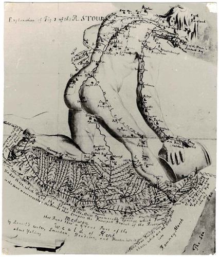
Figure 3. Drainage of south-east Kent represented by the body of a man. From a map in the Ankographia by Christopher Packe (a physician) from 1743.