Figures & data
Table 1. Number of calibration and validation pixels for different land-cover classes
Table 2. Accuracy measures of classifiers with and without spatial dependence
Table 3. Confusion matrix of non-spatial random forest classifier using validation samples
Figure 1. Land-cover maps produced by (a) non-spatial random forest classifier (top left), (b) random forest Getis classifier using 11 × 11 pixels moving window (top right) and (c) difference map of non-spatial random forest and random forest Getis (11 × 11 pixels) land-cover maps (bottom left).
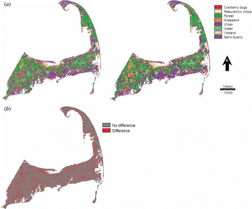
Table 4. Confusion matrix of random forest Getis classifier with 11 × 11 pixels moving window using validation samples
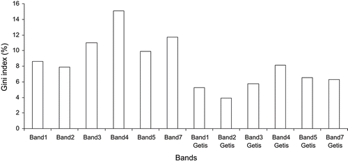
Figure 2. Variable importance contributions of different bands in terms of percent mean reduction in Gini index of the random forest Getis classifier with 11 × 11 pixels moving window.