Figures & data
Figure 1. The black square indicates the location of the study area. This area is an embayment within the eastern North Atlantic Ocean, which is represented in the bathymetry map of the Bay of Biscay with the buoys used in this work shown as red dots.
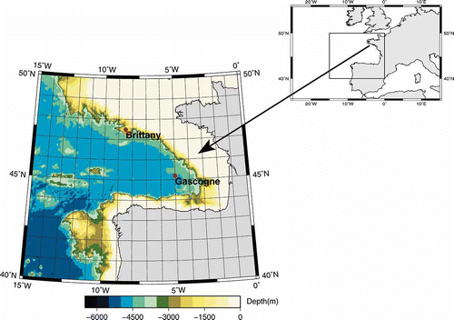
Table 1. Percentage of cloud coverage of the 92 daily images (three months) and percentage of cloud coverage remaining after removing the images with cloud coverage higher than 95%
Figure 2. The leading adimensional PC of (a) SST and (b) SST anomalies. Gaps reflect the existence of images with cloud cover higher than 95%.
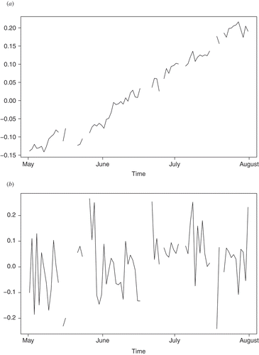
Table 2. Results of the study concerning the trend in the leading PC
Figure 3. RMSE obtained with cross-validation for reconstructions using different number of days in the database and diverse number of EOFs.
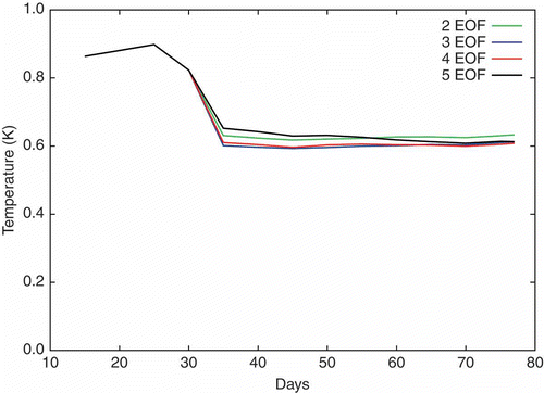
Table 3. Explained variance (%), RMSE (K) and the mean absolute deviation (MAD, K) between reconstructed data and original data and RMSE derived by means of the cross-validation techniques (Cross), in two experiments: (1) SST anomaly; (2) extended EOFs of SST anomalies with lag –1
Figure 4. Error obtained with cross-validation for reconstruction of the complete set.
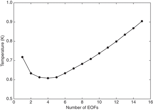
Figure 5. Mean absolute deviation (MAD) of reconstructed versus observed SST (K, left). Spatial structure of the EOFs. (a)–(d) First to fourth EOFs, which are shown scaled as SST anomalies (K units).
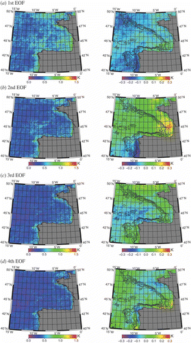
Figure 6. Percentage of reconstructed variance explained by each of the EOFs, computed with respect to the reconstructed variance at each point: (a)–(d) first to fourth EOFs.
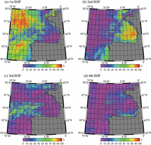
Figure 7. Comparison of (a) reconstructed data with original data and (b) reconstructed and original data with in-situ data from ship reports in ICOADS. The thin red line represents the fit corresponding to a perfect model (line y = x).
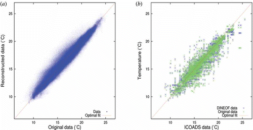
Figure 8. Comparison of the time-series from reconstructed SST with the time-series from MetOffice buoys: (a) Gascogne buoy; (b) Brittany buoy.
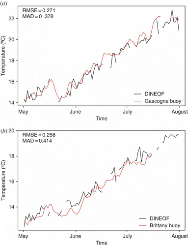
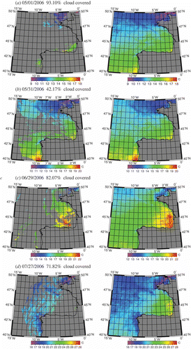
Figure 9. Different examples (dates and cloud-cover percentage) of original SST (left column) and corresponding DINEOF reconstructions (right column).