
Figures & data
Table 1. Description of land cover class categories considered in our study.
Figure 1. Map of collected ground control polygons segmented by a 250 m grid (purple polygons) and points used for independent validation of model results (refer to Section 2.7).
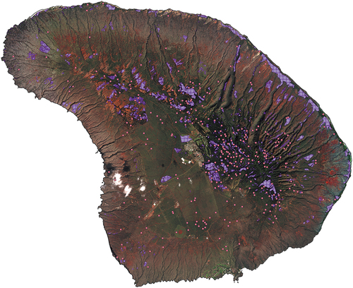
Table 2. Accuracy metrics by class for the species-specific land cover classification for the island of Lāna‘i. Prevalence refers to the proportion of actual positive cases (for a particular class) across the evaluation dataset. Detection prevalence refers to the proportion of predicted positive cases (for a particular class) across the evaluation dataset. Balanced accuracy is (sensitivity+specificity)/2.
Figure 2. Species-specific land cover map for the island of Lāna‘i, based on expert-adjusted class posterior probabilities. Masked areas under the triangular polygons were infrastructure areas excluded from the analysis (Lāna‘i City, airport and other infrastructure). Example zoomed in areas are provided in appendices 10 and 11.
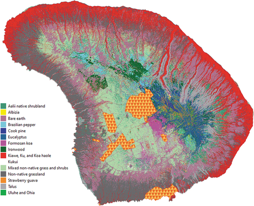
Figure 3. Example of individual class cover percent probability for the uluhe and ohia cover class.
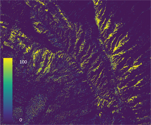
Table 3. Species-specific land cover area by class for the island of Lāna‘i, based on land cover classification including expert-adjusted class posterior probabilities.
Figure 4. Community-specific land cover map for the island of Lāna‘i, based on land cover classification including expert-adjusted class posterior probabilities. Masked areas under the triangular polygons were infrastructure areas excluded from the analysis (Lāna‘i City, airport and other infrastructure).
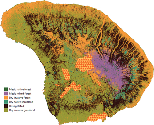
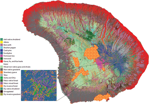
Figure 5. Mixed hierarchical land cover map for the island of Lāna‘i, based on land cover classification including expert-adjusted class posterior probabilities. Masked areas under the triangular polygons were infrastructure areas excluded from the analysis (Lāna‘i City, airport and other infrastructure). Map inset shows a high-elevation area with a mixture of species- and community-specific classes.
0_Berio_Fortini_lanai_cover_mapping_Supp_v2_NT.docx
Download MS Word (9 MB)Data availability statement
The associated data release for this manuscript and associated metadata is available publicly at Berio Fortini (Citation2024).