Figures & data
Figure 1. Hidroituango and armed group presence (2009–2018).
Source: Produced by author.
Map identifying the location of the Hidroituango dam project in Colombia, along with visual markers for the approximate location of different armed groups operating in the area between 2009 and 2018, including the FARC, Clan del Golfo, Caparrapos, and ELN.
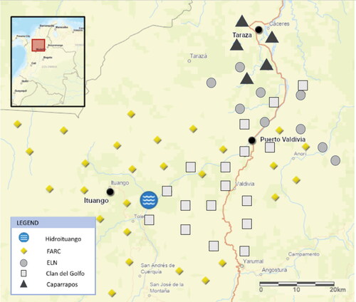
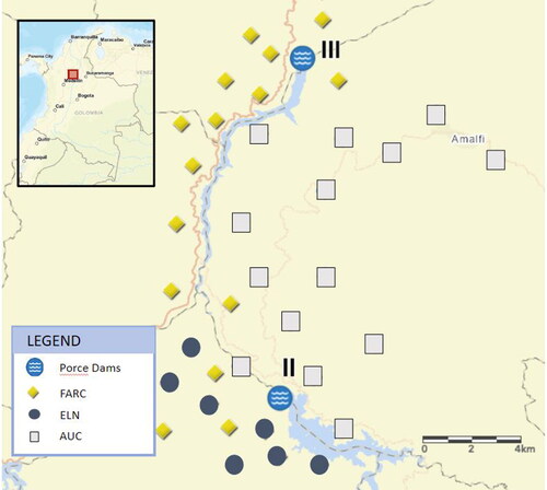
Figure 2. Porce II and Porce III dams and armed group presence (1995–2010).
Source: Produced by author.
Map identifying the location of the Porce II and Porce III dam projects in Colombia, along with visual markers for the approximate location of different armed groups operating in the area between 1995 and 2010, including the ELN, the FARC, and the AUC.