Figures & data
Figure 1. Satellite image of Techiman North District and surrounding areas with the known locations of suspected cases and enhanced satellite images of selected affected communities and forested areas. Images of affected communities include Nkoranza (a) and Techiman city (b, c). Images of forested areas include the Boabeng-Fiema Monkey Sanctuary (d), Tano Sacred Grove (e), and Bouyem Sacred Grove (f). Satellite images provided by Google Maps 2022.
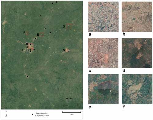
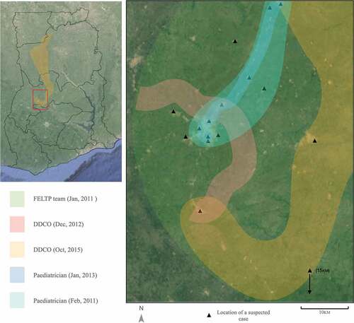
Figure 2. Satellite images of Ghana and the Techiman North District and surrounding areas overlaid with the purported locations of the forest. Satellite images provided by Google Maps 2022.