
Figures & data
Figure 1. India Meteorological department (IMD) best track of the Phailin cyclone.
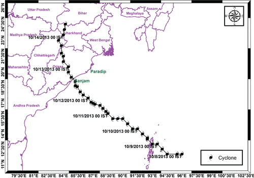
Figure 2. (a) Flexible unstructured mesh of the study area, (b) Enlarged view of figure 2a near Gopalpur where Phailin made landfall.
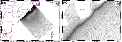
Figure 3. (a) Model computed storm tide (surge + tide), (b) Enlarged view of figure-3a near Ganjam, shows the inundation extent, (c) Temporal evolution of model computed surge residual (storm tide–tide) in meters at Ganjam. Red thick line is the track of Phailin.
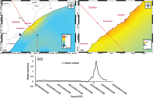
Figure 4. (a)Comparison of model computed storm tide in meters with that of observed at Paradeep. Arrow line indicates the land fall time, (b) Comparison of modeled residual with that of observed at Paradeep. Arrow line indicates the landfall time.
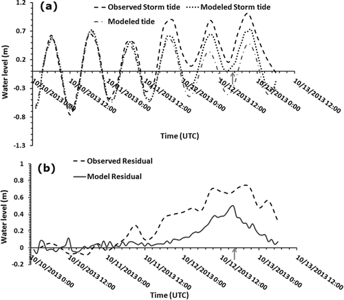
Table 1 Comparison of modeled and observed surge residuals due to Phailin.
Table 2 Validation of modeled inundation extent with field observations (inundation extent is the horizontal distance in meters from the zero contour line)
Figure 5. Spatial depiction of inundation extent (a) with cyclone had its landfall by 3 hours prior to the actual time of landfall, (b) with actual time of landfall, (c) with cyclone had its landfall by 3 hours after the actual time of landfall.
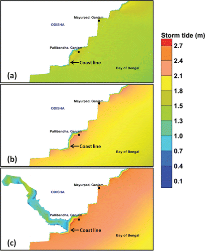
Table 3 Inter-comparison between modeled inundation extent with actual landfall time of Phailin and with idealized scenarios.