175
Views
3
CrossRef citations to date
0
Altmetric
Articles

Monitoring Narrow Mangrove Stands in Baja California Sur, Mexico Using Linear Spectral Unmixing

Pages 493-508 | Received 24 Jan 2020, Accepted 31 Mar 2020, Published online: 30 Apr 2020
 

Abstract

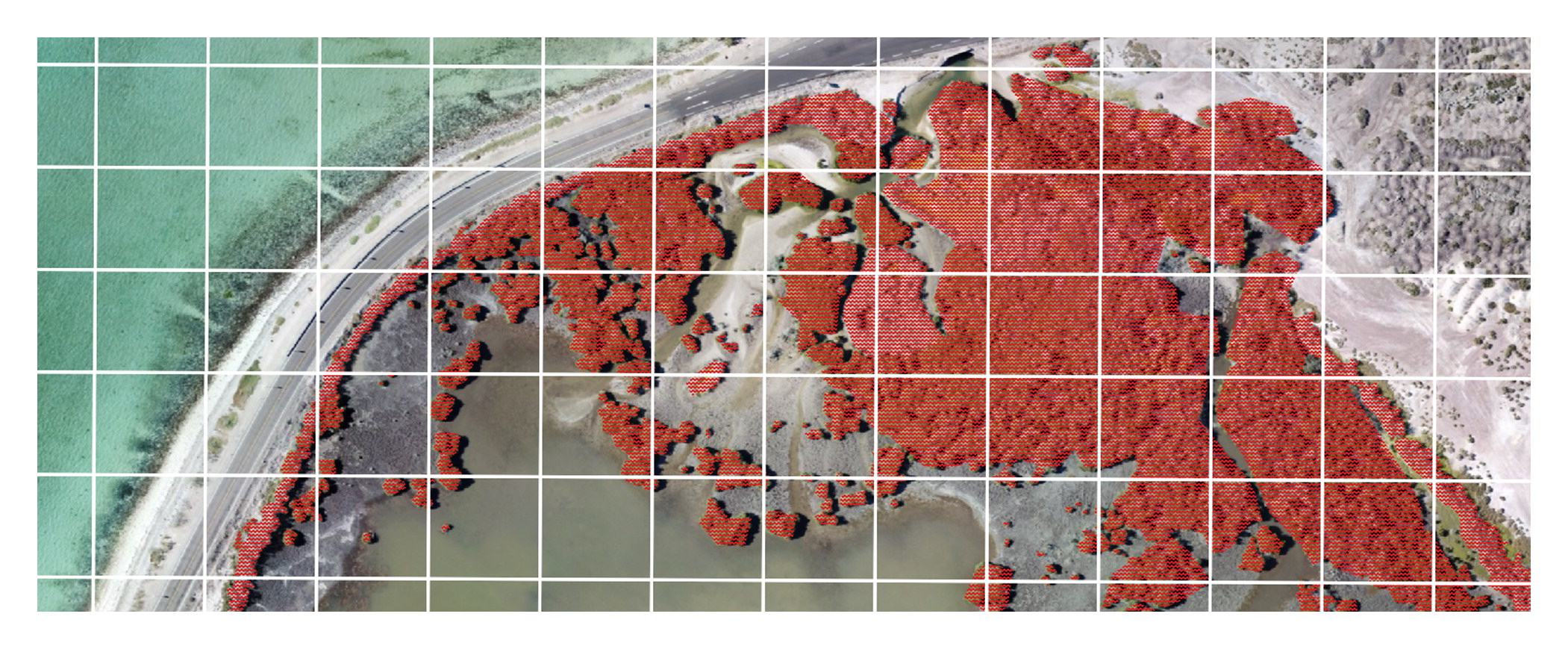
Small stands of mangrove trees are difficult to detect and monitor using satellite remote sensing because the width of the narrow strips of vegetation are typically much smaller than the spatial resolution of the imagery. Every mangrove pixel also contains water and bare soil reflectance. Linear spectral unmixing, which estimates the fractional presence of specific land cover types per pixel, was performed on Landsat 8 imagery to detect mangroves on the eastern shoreline of the Bay of La Paz on the Baja California Peninsula of Mexico. Low-altitude aerial imagery collected from a DJI Mavic Pro drone was used as ground-reference data in the accuracy assessment. Continuous fractional presence of mangroves was detected with 80% accuracy and 85% of mangrove area was found. Future work will use linear spectral unmixing to systematically monitor mangrove extent and health in the region relative to expected growth in tourism development.

Log in via your institution

Log in to Taylor & Francis Online

PDF download + Online access

  • 48 hours access to article PDF & online version
  • Article PDF can be downloaded
  • Article PDF can be printed
USD 61.00 Add to cart

Issue Purchase

  • 30 days online access to complete issue
  • Article PDFs can be downloaded
  • Article PDFs can be printed
USD 312.00 Add to cart

* Local tax will be added as applicable

Related Research

People also read lists articles that other readers of this article have read.

Recommended articles lists articles that we recommend and is powered by our AI driven recommendation engine.

Cited by lists all citing articles based on Crossref citations.
Articles with the Crossref icon will open in a new tab.