Figures & data
Figure 1. Map of Regional Tourism Organisations and list of regional/local Instagram accounts analysed (map source: Regional Tourism New Zealand). (Note: italicised names represent the accounts of local authorities with RTO functions; all others are RTO accounts).
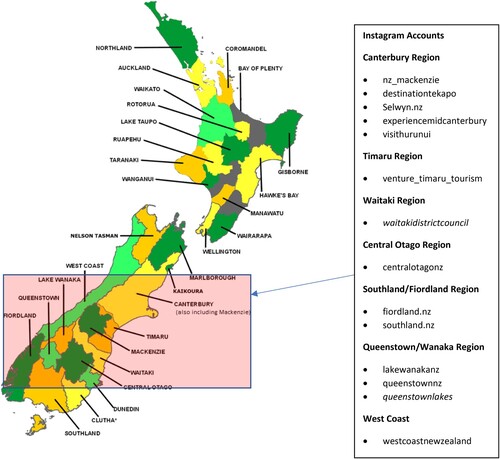
Figure 2. Distribution of wild Russell lupin in New Zealand and the lower South Island (source: inaturalist.org).
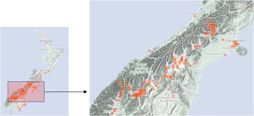
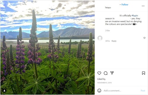
Figure 3. De-identified screen-captured ‘exhibit’.
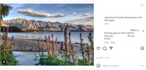
Table 1. Overview of Instagram accounts reviewed, and exhibits collected for further analysis.
Figure 4. Geolocation data for 94 posts containing Russell lupin (Note: no. in brackets = no. of posts per location; geolocation data not available for 4 posts) (Map source: Maptive).
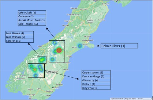
Figure 5. Church of Good Shepherd, Lake Tekapo, and Aoraki Mackenzie International Dark Sky Reserve framed by Russell lupin.
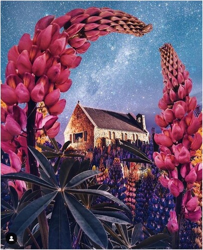
Figure 6. Selfie culture and the Russell lupin.
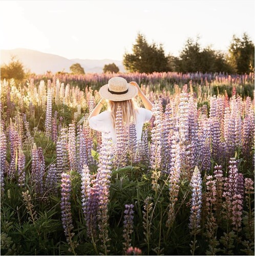
Figure 7. Notification of invasive weed status of Russell lupin alongside iconic representation.