Figures & data
Fig. 1 Overview of the assessment area; the model was set up between Mongalla and Shambe, and the image shows main channels and lagoons in this area. The core area of interest, which has been assessed in detail, is located on the right bank between Baidit/Padak and Jalle.
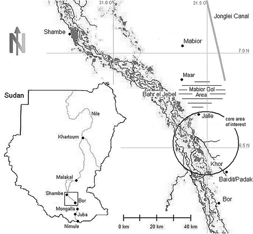
Fig. 2 Papyrus: dense swamp vegetation, typically with a height of between 3 and 5 m.
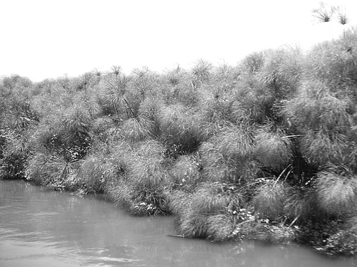
Fig. 3 Schematic cross-section of the Sudd swamps north of Bor showing the river channel on the inland delta sediment ridge and the lateral water level gradients caused by spill, evapotranspiration and flow resistance.
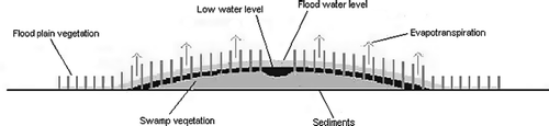
Fig. 4 Flows at Mongalla and water-level records at different locations in the southern Sudd swamps, derived from Hurst & Phillips (Citation1932 and Supplements). The levels given in NKL (New Khartoum Level) datum were corrected to SRTM levels. Flows and levels are directly related as shown in the inlay. The locations of the numbered stations are shown in Fig. 5.
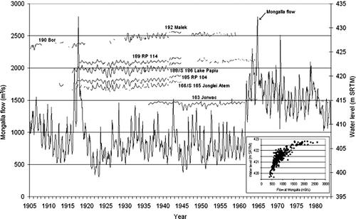
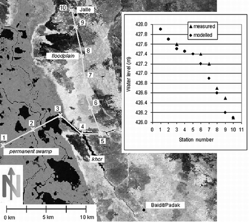
Fig. 5 Dry season Landsat image of the model area showing the swamp with water-level monitoring station numbers and locations, as well as the enlarged core assessment area between Baidit/Padak and Jalle with numbers of further monitoring locations.
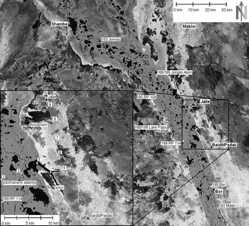
Table 1 Parameters used for sensitivity assessment
Fig. 6 Water depth, inundation extent and velocities under typical dry season low-flow conditions (1000 m3/s swamp inflow at Mongalla). While the channel flow velocities are well visible, flow velocities within the papyrus areas are hardly visible due to their small values.
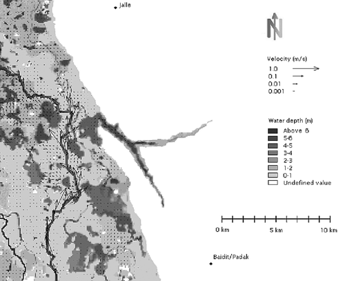
Fig. 7 Water depth, inundation extent and velocities under typical rainy season high flows (2000 m3/s swamp inflow at Mongalla) in the core assessment area. Water is flowing down the seasonal flood plains, which are inundated under these conditions.
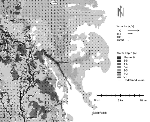
Fig. 8 Inflow–water level relationship for different station locations in the model area (as shown in Fig. 5). The curves, corrected to SRTM level, may vary depending on the long-term flow regime with related vegetation dynamics. Station names are given together with the respective station numbers.
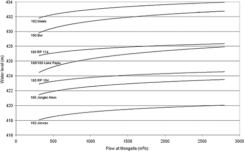
Table 2 Comparison of both measured historical and recent water levels and modelled water levels.*
Fig. 9 Modelled and measured water-level gradient along a line from the centre of the swamps through lagoons and khors onto the seasonal flooded grasslands under rainy season average high-flow conditions (2000 m3/s at Mongalla). The Landsat background image (NASA, Citation2008b) shows dry season conditions for better visualization.