Figures & data
Fig. 1 Location of reservoirs in the Tunisian Dorsal area.
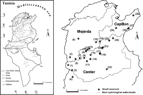
Table 1 Physical and hydrological characteristics of studied catchments. Rainfall events correspond to 15-min duration maximum intensity (from Jebari et al., Citation2008)
Table 2 Reservoirs and observation of siltation
Table 3 Observation periods and data for reservoirs (for Mrira, Bouhaya, Jedeliane, and Baouejer the period of maximum soil loss could not be determined)
Fig. 2 Long-term (1925–2004) soil loss as compared to soil loss during the study period (1993–2002).
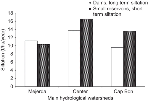
Fig. 3 Soil cover characteristics. Bedrock exposed at the surface at a small (a) and at a large scale (b) in the observation area.
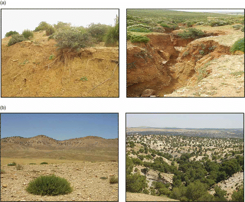
Fig. 4 Relative importance of erosion type depending on catchment. Catchments are listed according to location in the degradation cycle: (a) illustrates the average soil loss, and (b) the maximum soil loss.
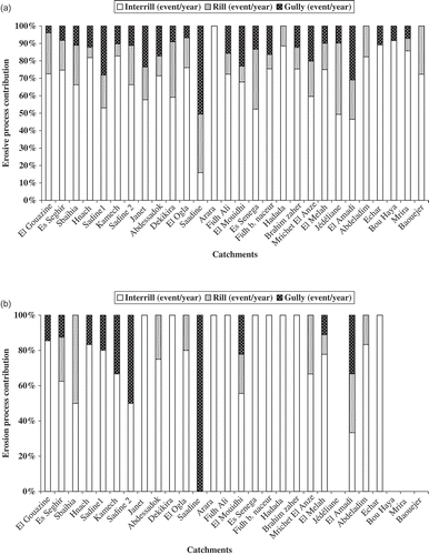
Fig. 5 (a) Distribution of average and maximum soil loss rates. (b) Average versus maximum soil loss. Catchments are arranged according to increasing values.
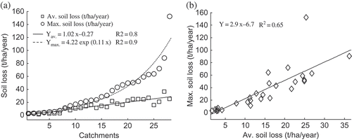
Fig. 6 The Tunisian Dorsal landscape in general and the experimental catchments in particular demonstrate different stages in the soil degradation cycle. Numbers correspond to catchments in
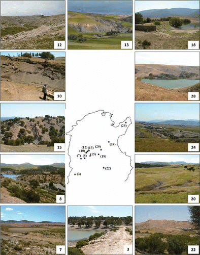
Fig. 7 Soil degradation cycles (I, II and III) depending on average and maximum soil loss rates. In the list to the right, stations are arranged according to their degradation levels as determined during field visits.
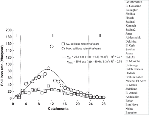
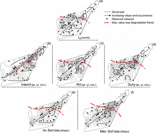
Fig. 8 (a) Spatial distribution of maximum 15-min duration rainfall intensity (1993–2003; Jebari et al., Citation2008), (b) (c) and (d) estimated number of annual events for different erosion types: inter-rill, rill, and gully erosion; (e) and (f) observed average and the maximum soil loss in t ha−1 year−1.