Figures & data
Fig. 1 Location map showing the main topographic features bounding the study area.
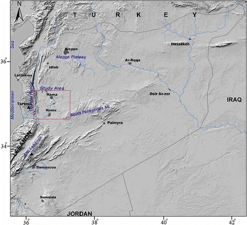
Fig. 2 (a) Simplified geological map of the study area; (b) schematic cross-section A–A′; and distribution of the sampling sites, nos. 1–40. Key: 1: Jurassic, 2: Upper Cretaceous aquifer (limestone and dolomites), 3: Upper Cretaceous (clay and limestone of Senonian to Maestrichtian), 4: Palaeogene (chalks and marls), 5: Neogene (conglomerates and limestone aquifer), 6: Basalt (Miocene/Pliocene) aquifer, 7: Quaternary, 8: Main faults, 9: Wells, 10: Cities.
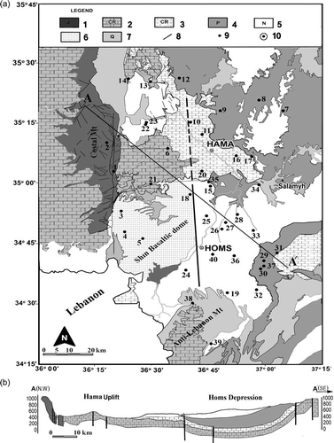
Table 1 Mean chemical composition and field data of groundwater samples from the Upper Cretaceous aquifer in the Orontes basin. See for location of sites
Fig. 3 Average concentration and geochemical facies of the dominant groundwater groups in the study area.
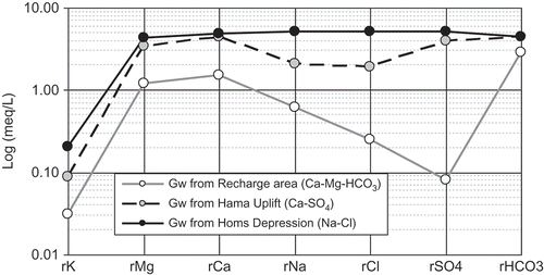
Fig. 4 Relationship between different cations and anions in the groundwater of the studied area.
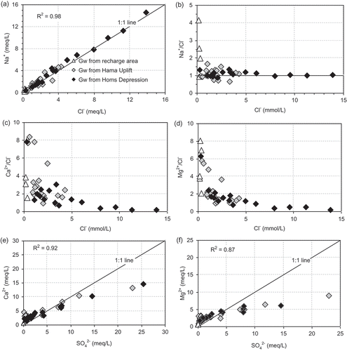
Fig. 5 Relationship between mineral and water saturation indexes (SI) of calcite, dolomite, gypsum and halite.
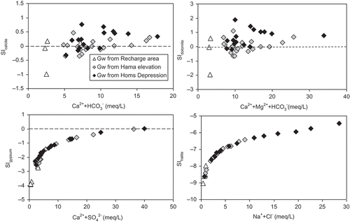
Table 2 Isotopic composition of groundwater samples collected from the Upper Cretaceous aquifer system in the Orontes basin. See for location of sites
Table 3 Mean isotopic composition values of the three groundwater clusters of the Upper Cretaceous aquifer in the Orontes basin
Fig. 6 δ18O–δ2H diagram of groundwater samples from the Upper Cretaceous aquifer in the Orontes basin. The mean and standard deviations of the δ values of the rainwater collected at the monitoring stations Bloudan and Kadmous are also shown.
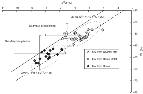
Fig. 7 The δ18O (blue) and dex (green) values plotted vs groundwater 14C age (A0 = 60 pmC) form six distinct clusters which are discussed in the text.
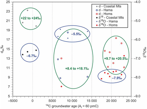
Table 4 Application of 14C age correction models for groundwater in the Orontes basin
Fig. 8 Evolution of 14C and δ13C values in the groundwater samples from the Upper Cretaceous aquifer in the study area.
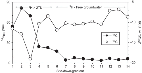
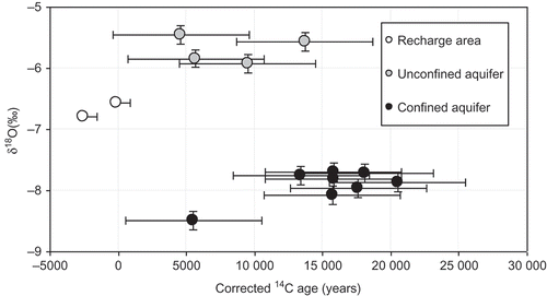
Fig. 9 Relationship between δ18O and corrected age values for groundwater in the study area. Standard deviation shown by ± “whiskers” (5000 years for 14C age and 0.1‰ for δ18O).