Figures & data
Fig. 2 Outcrop view of the fractured crystalline bedrock (anorthosite) of the Saguenay-Lac-St-Jean region located in Quebec, Canada.
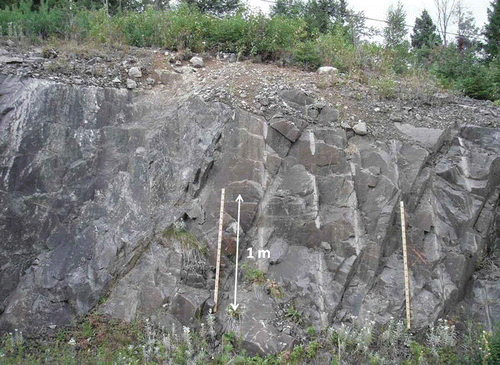
Fig. 1 Study location: crystalline rock aquifer of the Kenogami Uplands located in the Saguenay-Lac-St-Jean region in the province of Quebec, Canada.
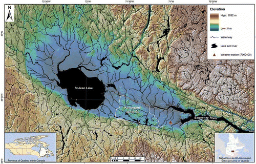
Fig. 3 Mean monthly precipitation, Station 7060400 in Bagotville (Environment Canada Citation2011).
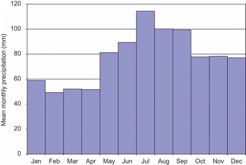
Fig. 4 Location of the individual wells installed in the anorthosite bedrock in the Kenogami Uplands and of cross-section A–A′.
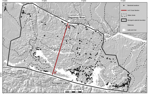
Fig. 5 Conceptual Dupuit-Forchheimer regional flow model applied to the Kenogami Uplands along cross-section A–A′ shown in Fig. 4.
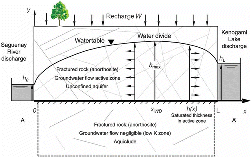
Fig. 6 Log(K) data histogram with hydraulic conductivity calculated from specific capacity tests in the 326 wells of the Kenogami Uplands installed in the fractured bedrock (S = 0.01). Note that the K values are in m/s.
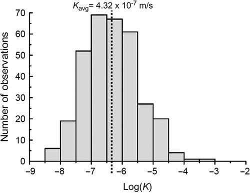
Fig. 7 Map of the lineament locations and the different ranges of hydraulic conductivities obtained from specific capacity tests in 326 wells located within the Kenogami Uplands and installed in the fractured bedrock.
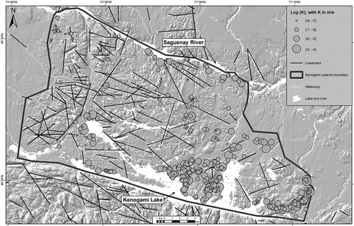
Table 1 Sensitivity analysis results of specific yield S on hydraulic conductivity K
Fig. 8 Variation of hydraulic conductivity as a function of the length of the open borehole.
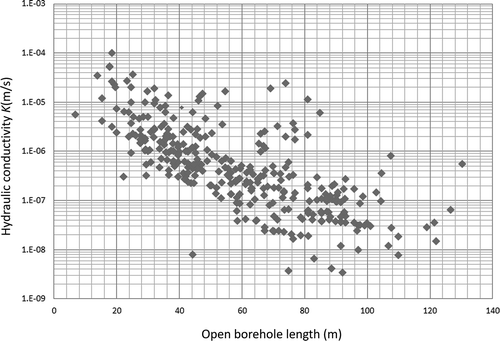
Fig. 9 (a) Interpolated saturated thickness in the Kenogami unconfined fractured rock aquifer. (b) Interpolated water table elevation profile and DEM along cross-section A–A′. Note that the water table elevations in both pictures are expressed in metres above the basement of the active zone of the aquifer.
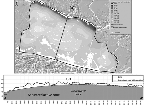
Fig. 10 Interpolated squared saturated thickness (h 2) along cross-section A–A′ in the Kenogami Uplands unconfined fractured rock aquifer in the case of 100 m thickness of the active zone.
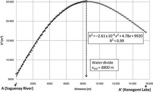
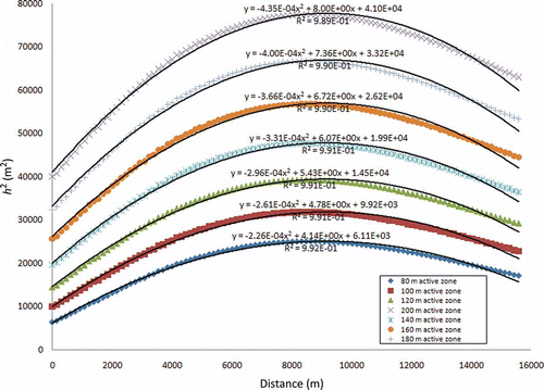
Fig. 11 Interpolated squared saturated thickness (h 2) along cross-section A–A′. Different cases of the active zone thickness are presented in order to perform a sensitivity analysis.