
Figures & data
Fig. 1 Map of Uganda showing the distribution of observatories and the size of the main drainage sub-basins. Source of original map: MWE (Citation2005).
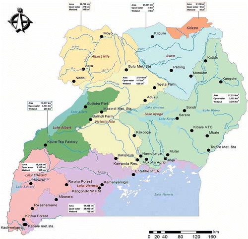
Fig. 2 Data preprocessing steps and analysis used in the study.
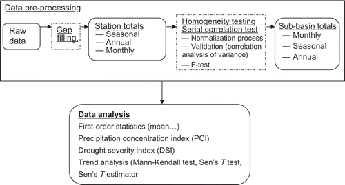
Table 1 Basic statistical characteristics of annual rainfall data for the 35 stations in the seven drainage sub-basins in the period 1940–2009.
Fig. 3 Regional total rainfall (mm) for the period 1940–2009.
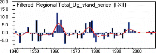
Fig. 4 Seasonal cycle in Ugandan rainfall between the seven sub-basins.
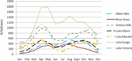
Fig. 5 Variation of rainfall in the main drainage sub-basins in Uganda 1940–2009. Variability is expressed as percentage of CV at rainfall stations.
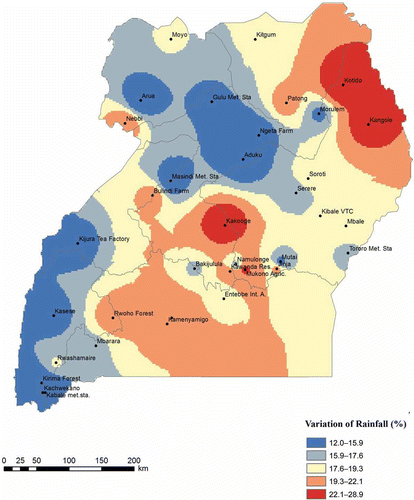
Table 2 Results from PCI calculations using temporal and seasonal concentration methods.
Fig. 6 Distribution of long-term mean monthly rainfall (mm) in the sub-basins of Uganda from 1940 to 2009.
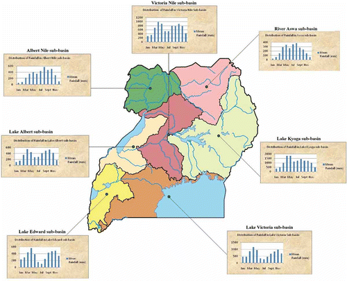
Table 3 Temporal rainfall characteristics in the main drainage sub-basins of Uganda.
Fig. 7 Spatial distribution of negative (–) and positive (+) trends for annual total rainfall in the main drainage sub-basins in Uganda.
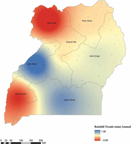
Fig. 8 Variations and trends in normalized annual rainfall anomalies series with nine-point Gaussian filter, over the main drainage sub-basins in Uganda.
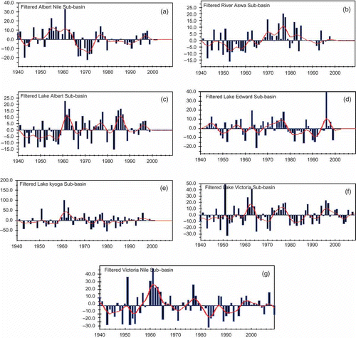
Fig. 9 Spatial distribution of negative (–) and positive (+) trends for seasonal distribution of rainfall for the period 1940–2009 in the main drainage sub-basins of Uganda. Magnitude is in mm/season (not indicated on map).
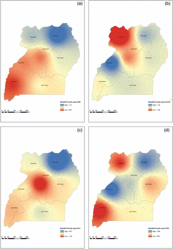
Table 4 Coefficients of correlation between annual and seasonal rainfall departure series for main drainage sub-basins in Uganda.