
Figures & data
Figure 1. Map showing the locations of sampling sites including geographical features in Xinjiang Autonomous Region. The Aksu River is located on the southern slopes of the Tianshan Mountains. The solid red star represents the hydrological station.
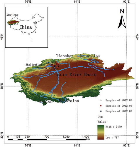
Table 1. Mean measurements of surface water and groundwater during different season in the Aksu River basin.
Figure 2. Plots of δ18O versus δ2 H of surface water samples collected from (a) the Kumalak River and (b) the Toxkan River.
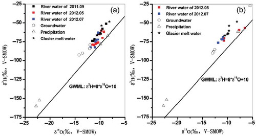
Figure 3. Comparison of the altitude–δ18O relationship for the Kumalak and Toxkan rivers during the wet season.

Figure 4. River water δ18O and streamflow plots with time for Xiehela station in the Kumalak River sampled during 2012 to 2013.
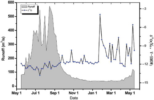
Figure 5. River water δ18O at Xiehela station and Shaliguilanke station in the Aksu River basin during the whole of 2012.
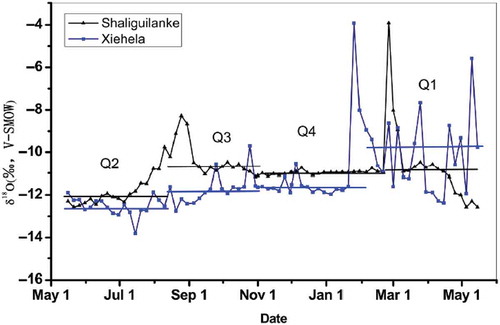
Figure 6. Relationships between TDS–δ18O of river water, groundwater, glaciermelt water, snowmelt water and precipitation during three periods along the Aksu River basin.
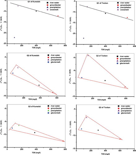
Table 2. Estimated fractions of water sources as a result of hydrograph separation for the Kumalak River.
Table 3. Estimated fractions of water sources as a result of hydrograph separation of the Toxkan River.