Figures & data
Fig. 1 Digital elevation map for the Friuli region showing location of the OSMER radar and outline boundaries of the Fella basin at Moggio.
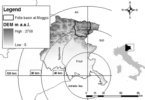
Fig. 2 Left: Map of the Fella basin at Moggio (Basin 11) showing outlet locations of the sub-basins examined in this study. Right: Total rainfall accumulation map over the study area for the 2003 storm event examined.
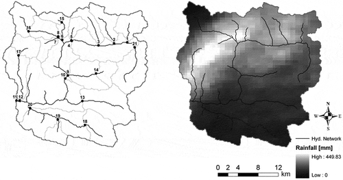
Fig. 3 Tracks of rainfall cells for the 29 August 2003 storm: (a) 12:00–14:00 UTC, (b) 14:00–16:00 UTC and (c) 16:00–18:00 UTC.
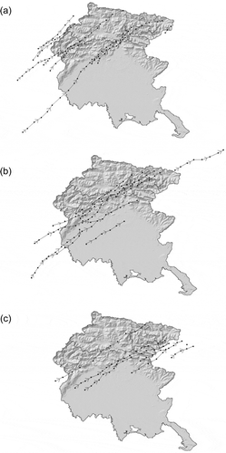
Fig. 4 Time series (15 min) showing (from top to bottom) the basin-averaged rainfall, the fraction of basin area covered by rain >20 mm h-1, coefficient of variation of non-zero rain-rates, δ1 and δ2. Each column corresponds to a different basin.
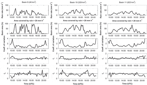
Fig. 5 Boxplots showing the distribution of catchment-scale storm velocity for each sub-basin vs basin area. Values are: (a) based on using a fixed regression window of 1 h; and (b) calculated using a variable regression window based on the mean response time for each basin. Open circles correspond to values that exceed 1.5 times the interquartile range of the distribution for each case.
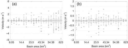
Fig. 6 Mean absolute storm velocity vs basin area: (a) average velocity, V, calculated based on a fixed hourly regression window; and (b) averaged Vs values based on a variable time window equal to the basin’s mean response time.
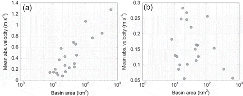
Fig. 7 Nash–Sutcliffe (NS) scores calculated between the control hydrographs and those corresponding to constant pattern (triangles) and uniform (circles) rainfall, ranked in ascending order, for (a) tRIBS and (b) KLEM. The three selected basins are identified with respect to the constant pattern results. The downward-pointing arrows in the left plot indicate that there are three points at these locations below the NS threshold of 0.5.
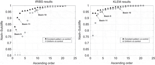
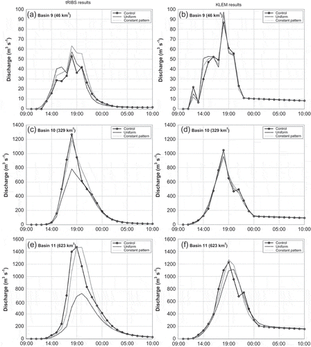
Fig. 8 Simulated hydrographs based on tRIBS (left) and KLEM (right) models for three selected basins. Results are shown for scenarios of original rainfall forcing (control), uniform rainfall (uniform) and constant rainfall pattern (constant pattern).