
Figures & data
Table 1. Water balance parameters. R: rainfall; PET: potential evapotranspiration; AET: actual evapotranspiration; RUPS: reserve useful for plant survival (max. = 32).
Figure 1. Location map of Tunisia and the Gabes region (projection system: TUN UTM; datum: WGS_1984; zone: 32).
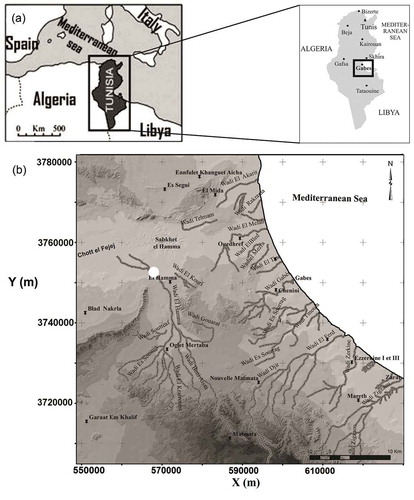
Figure 2. (a) Correlation of rainfall with temperature and years. (b) Monthly rainfall variability at the climatological station Gabes SM in the period 1985–2015. (c) Correlation of rainfall–PET from Gabes SM station. (d) Abstraction of Mio-Plio-Quaternary aquifer in the Gabes region. (e) Piezometric map.
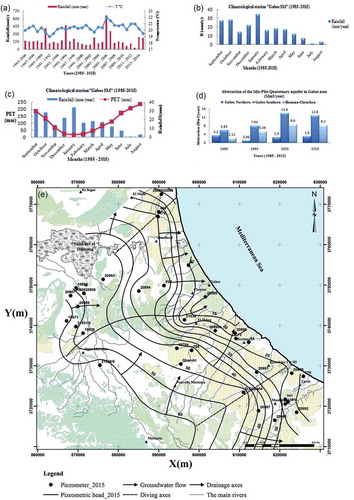
Table 2. Scores assigned to the parameters influencing each recharge potential factor (modified after Krishnamurthy et al. Citation1996, Edet et al. Citation1998, Shahid et al. Citation2000, Jaiswal et al. Citation2003, Shaban et al. Citation2006, Magesh et al. 2011, Kaliraj et al. Citation2014, Oikonomidis et al. Citation2015, Senanayake et al. Citation2016, Yeh et al. Citation2016)..
Table 3. Criteria for classification of hydrological soil group (Chow et al. 1988, Viessman et al. Citation1989).
Figure 3. Schematic representation of the methodology adopted to delineate the groundwater recharge potential zone of the Gabes region.
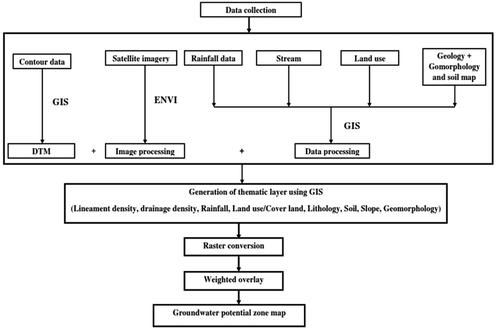
Figure 4. Interrelationship between the multiple influencing factors concerning the recharge property.
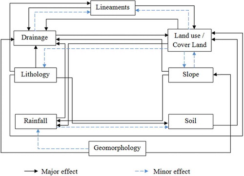
Figure 5. Lineament density map of the Gabes region.
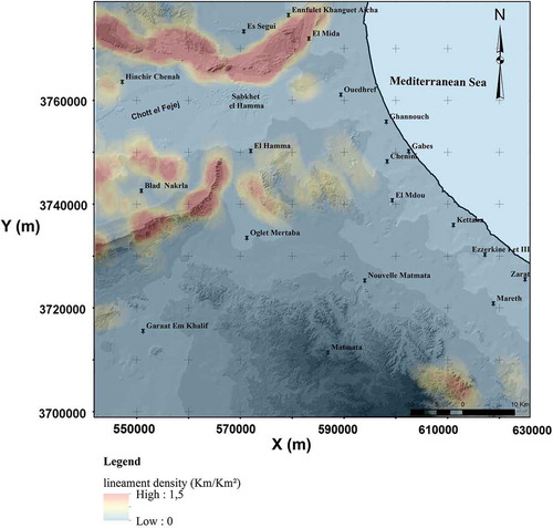
Figure 6. Rose diagram of the lineament orientation in the Gabes region.
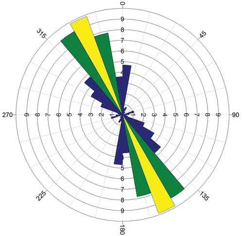
Figure 7. Drainage density map of the Gabes region.
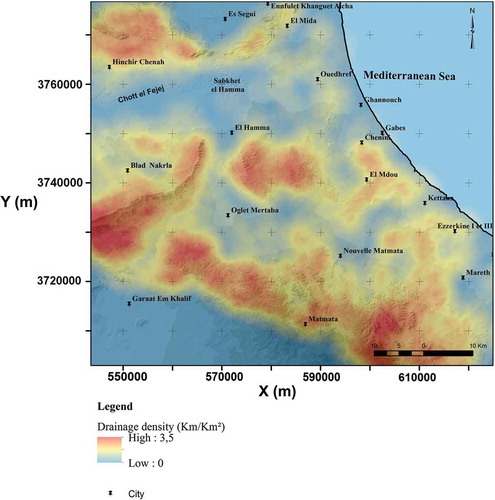
Figure 8. Slope map of the Gabes region.
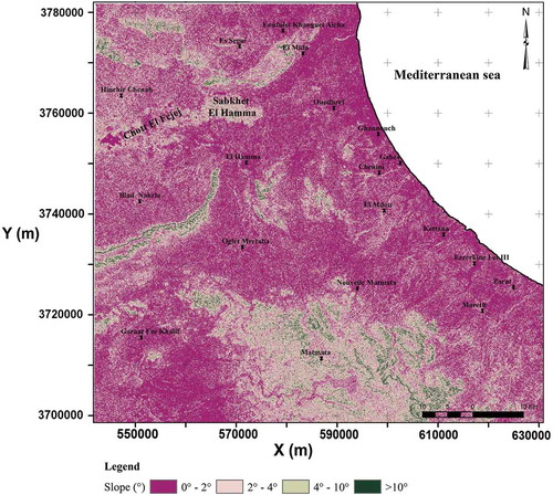
Figure 9. Soil types map of the Gabes region.
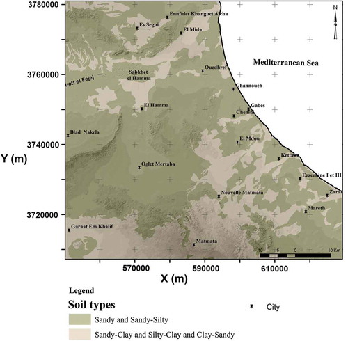
Figure 10. Rainfall map of the Gabes region.
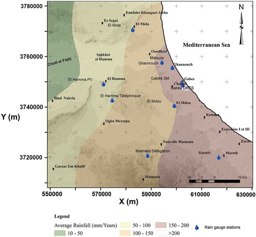
Figure 11. Correlation between precipitation (P) and elevation.
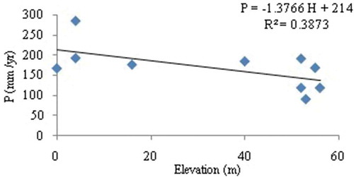
Figure 12. Land-use/land-cover map of the Gabes region.
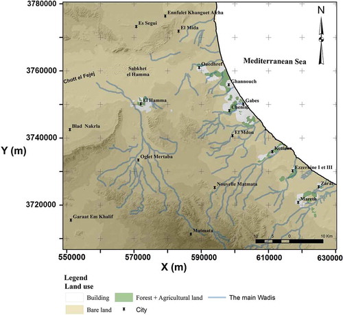
Figure 13. Lithology map of the Gabes region.
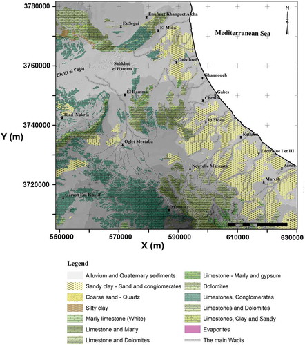
Figure 14. Geomorphology map of the Gabes region.
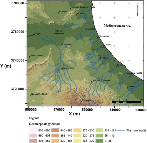
Figure 15. Distribution of groundwater potential classes in the Gabes region.
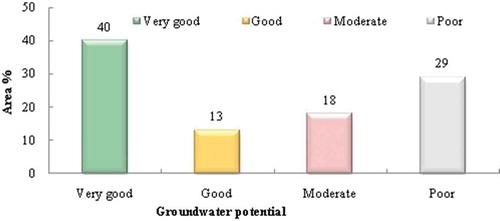
Figure 16. Groundwater recharge potential zone map of the Gabes study area.
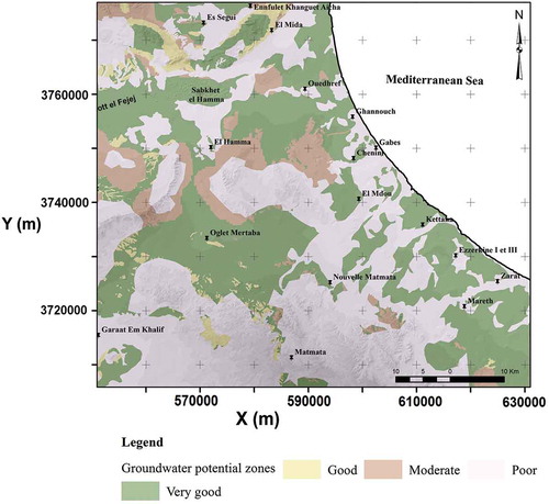
Table 4. Classification of various factors for delineation of groundwater potential zones.
Table 5. Groundwater recharge potential zones and categorization.