Figures & data
Figure 1. Map showing the location of East Arnhem Land, Milingimbi Island, and the other locations discussed in the Yolŋu Aboriginal water story
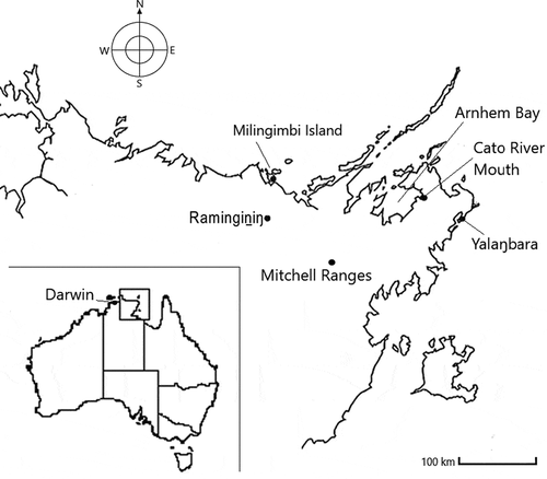
Figure 2. Map of Milingimbi Island, 1976, by Wunyimarra, showing the ownership of clan estates in Gupapuyŋu language
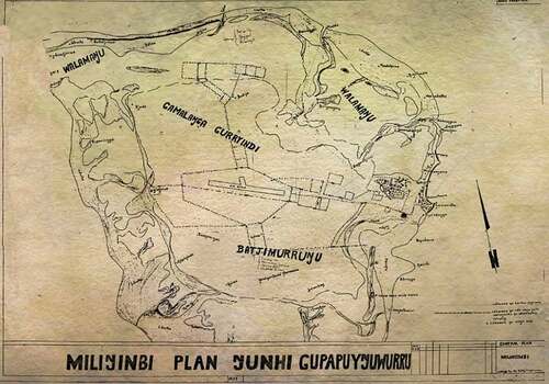
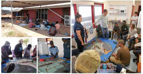
Figure 3. Engaging with local community members in training and use of geophysical instruments. Photos used with permission of Eddie W. Banks; copyright 2014 Crocodile Island Rangers
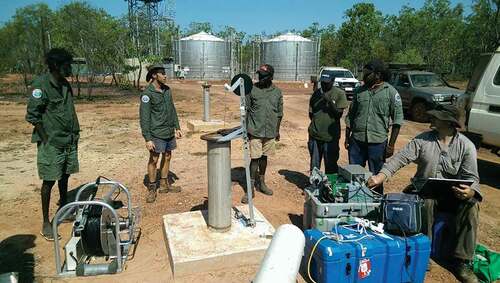
Figure 4. Participatory three-dimensional mapping (re)presenting both Milingimbi gapu and Western science hydrology. Photographer: Yasunori Hayashi