Figures & data
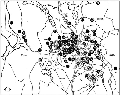
Figure 1. 1979 survey map of Upplands Väsby and its surroundings, showing the municipality at the height of welfare planning. Source: Lantmäteriet.
Figure 2. Illustration from the 1970 Public Inquiry on the outdoor environment of children, showing a characteristic blending of modernist housing, pastoral landscapes and everyday leisure pursuits. Source: Kungliga biblioteket.
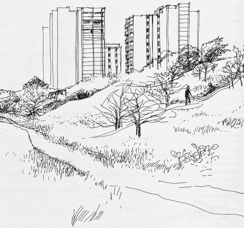
Figure 3. The recreation centre, a model originally developed by the Ski and Outdoor Association. Source: Statens naturvårdsverk.
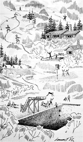
Figure 4. 1965 Photograph of residential area near Upplands Väsby train station, built in 1952 just after the municipality's first Comprehensive Plan came into effect. Source: Stockholms Länsmusuem. Photograph by Alf Nordström licensed under CC BY.
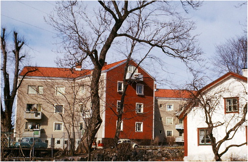
Figure 5. Public spaces within housing areas were meticulously planned to support a range of uses and connected to large green spaces, like in this 1969 plan for Smedby. Source: Upplands Väsby Municipal archives.
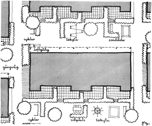
Figure 6. A map of central Upplands Väsby attached to the 1966 Comprehensive Plan showing residential areas as white spaces marked ‘B’, enmeshed in a continuous corridor of public space consisting of civic buildings, parks and patches of forest. Source: Upplands Väsby Municipal archives.
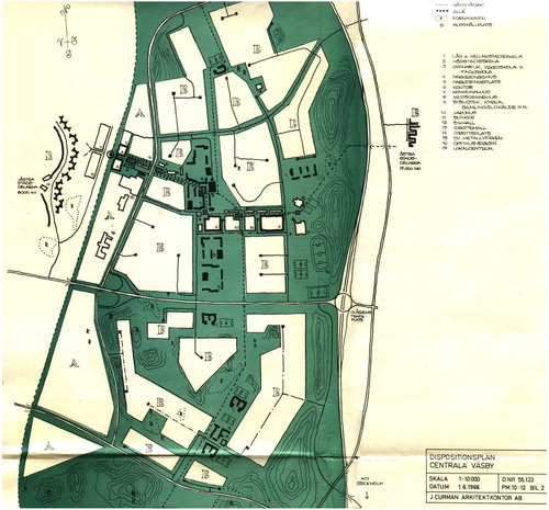
Figure 7. K-Konsult’s 1973 leisure investigation divided the municipality into four zones around a primary school, and proposed ‘exercise centres’ (marked as striped areas) for each zone. Source: Upplands Väsby Municipal archives.
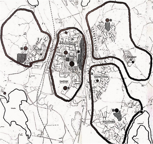
Figure 8. K-Konsult’s ‘principle draft for local exercise centre’, to be located next to each secondary school. Source: Upplands Väsby Municipal archives.
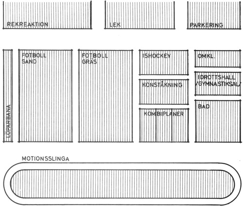
Figure 9. The existing infrastructure for leisure in Upplands Väsby according to the 1976 Leisure Plan. Source: Upplands Väsby Municipal archives.