Figures & data
Figure 1. Bangalore in the late nineteenth century. The parkland, Cubbon Park separates the Pettah or Bangalore city on the left from the Cantonment that became the C & M Station. Source: John Bartholomew, available in the Public domain, via Wikimedia Commons.
Figure 2. Yellow indicates the native Indian states or princely states in contrast to pink which represents territories of British India, territories that were permanently administered by the GOI as of 1909. Source: Available in the Public domain, via Wikimedia Commons.
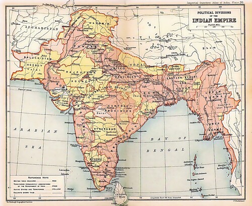
Figure 3. View of the replicated bungalow with setbacks in Fraser town. Source: Popular Mechanics Magazine.
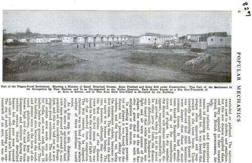
Figure 4. Cover of popular mechanics magazine and a full page on Fraser town. Source: Popular Mechanics Magazine.
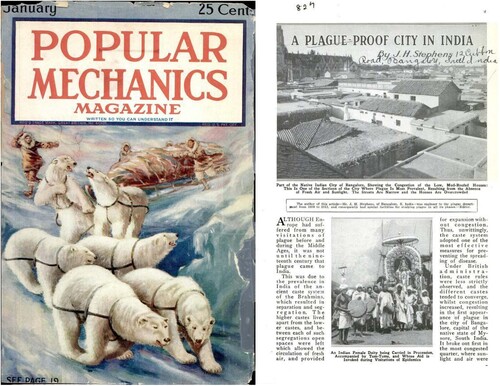
Figure 5. Shows the land acquired in Papareddipalya in relation to the C & M Station’s General Bazaar. Source: Cantonment and City of Bangalore and Environs Season 1884-85. Map Courtesy: The Mythic Society Bangalore Photo: Authors Own.
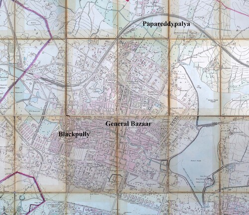
Figure 6. Principal roads were sunk below ground level and drains placed. Source: Stephens, J. H. (1914). Plague-Proof Town Planning in Bangalore, South India. Madras: Methodist Publishing House. Source: The British Library.
Figure 7. Smaller houses showing where the plot to the built ratio (4:1). Source: Stephens, J. H. (1914). Plague-Proof Town Planning in Bangalore, South India. Madras: Methodist Publishing House. Source: The British Library.
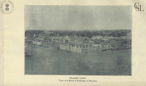
Figure 8. Larger houses dubbed ‘cottages’. Source: Stephens, J. H. (1914). Plague-Proof Town Planning in Bangalore, South India. Madras: Methodist Publishing. Source: The British Library.
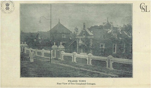
Figure 9. Fraser town near later planned developments of Richards Town and Cooke Town in relation to the General Bazaar. Bangalore Guide Map 1935-36. Map Courtesy: The Mythic Society Bangalore. Photo: Authors Own.
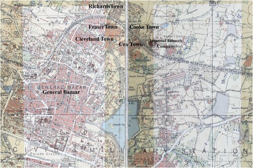
Figure 10. Second All-India Sanitary Conference Mr V. Rangaswamy Iyengar, Superintending Engineer of the Southern Circle, Mysore State standing 8th in the third row from the top wearing a Mysore Petta Dr S Amritraj, C & M Station, Bangalore (not in image) and the eighth person in the first row from the left, President of the conference, Sir Harcourt Butler. Source: The Proceedings of the Second All-India Sanitary Conference. Volume I – General. Government Press. 1913. Source: Wellcome Trust.
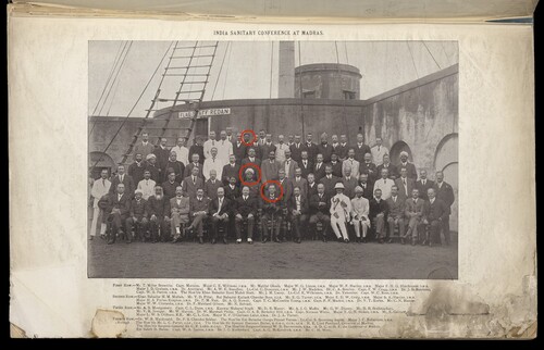
Figure 11. Third All-India Sanitary Conference Mr K. Krishna Iyengar, B.A., L.C.E Deputy Chief Engineer, Mysore Durbar (absent) and Eighth person in the first row from the left, President of the conference, Sir Harcourt Butler. Source: Wellcome Trust.
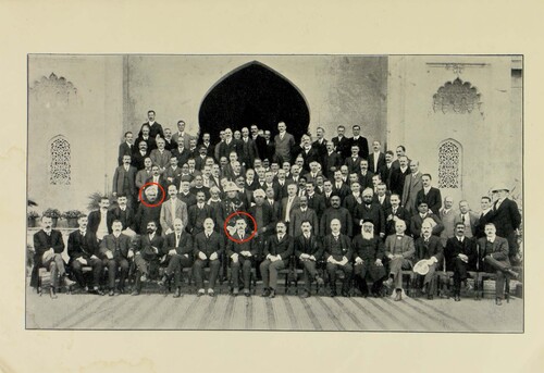
Figure 12. J.P Orr’s 631?2 rule illustrated diagrammatically. Source: Proceedings of the Third All-India Sanitary Conference held at Lucknow, January 19th to 27th 1914 Vol IV. Source: Wellcome Trust.
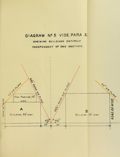
Figure 13. Sheet No 1 showing the extensions in Bangalore City. Proceedings of the Third All-India Sanitary conference held at Lucknow, January 19th to 27th 1914 Vol IV. Wellcome Collection.
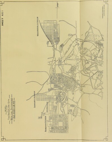
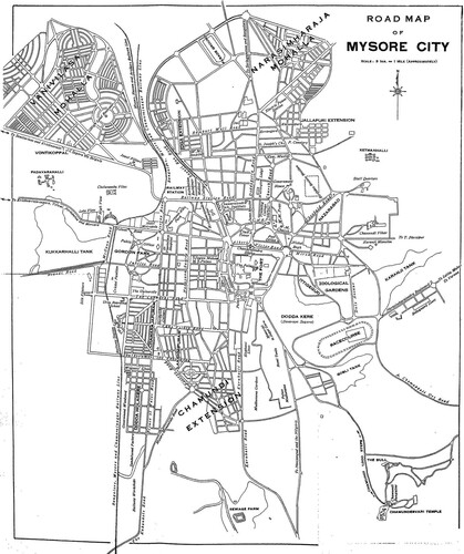
Figure 14. Map of Chamarajapuram, Lakhsmipuram and Chamundi Extensions in Mysore. Source: Constance E. Parsons, Public domain, via Wikimedia Commons.