Figures & data
Figure 1. Water bodies assessed for gizzard shad survival and reproduction. Shading represents mean annual temperature (°C) from 1971 to 2000 (US Department of Agriculture 2010).
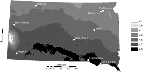
Table 1. Characteristics for all South Dakota waterbodies from which gizzard shad reproduction was compared.
Figure 2. Larval gizzard shad density estimates (number/100 m3 ± SE) for East Krause Lake and Middle Lynn Lake.
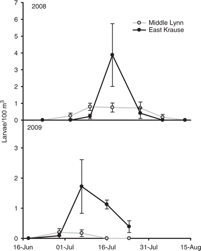
Figure 3. Length-frequency histograms (10-mm length groups) for age-0 gizzard shad collected from East Krause and Middle Lynn lakes.
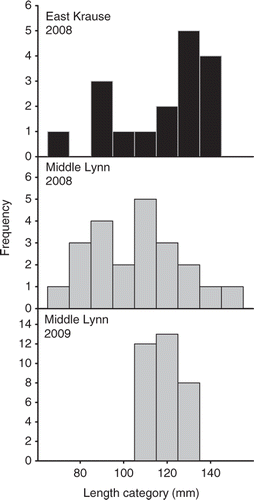
Table 2. Mean peak larval density (number/100 m3) estimates for gizzard shad from various South Dakota water bodies during 2008 and 2009.
Figure 4. Mean daily water temperature taken at the sediment-water interface at a depth of approximately 4 m in East Krause Lake (black line) and Middle Lynn Lake (grey line) during the 2009–2010 winter. The grey, dashed horizontal line represents the threshold at which mortality has been reported for gizzard shad.
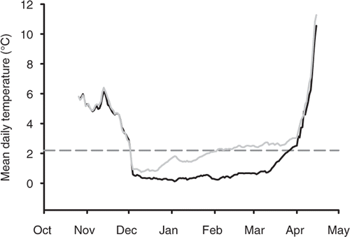
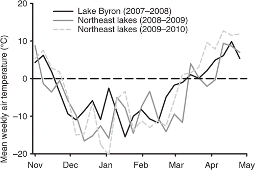
Figure 5. Mean weekly air temperatures (weather underground) during the 2007–2008 winter (November–April) near Lake Byron and the 2008–2009 and 2009–2010 winters near the northeastern South Dakota glacial lakes (Middle Lynn Lake and East Krause Lake).