Figures & data
Figure 1. Locations of the stations used for model evaluation using surface relative humidity data.
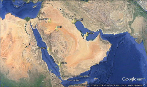
Table 1. Statistical parameters: BIAS, RMSE, correlation coefficient, NME and NMB for the entire period of simulations (January 2014–December 2015) with dust effects (WDE) and without dust effects (NDE) for relative humidity, for 6 different surface stations (Doha, Jeddah, Gizan, Al-Jouf, Kuwait, Hail).
Figure 2. Dust load as average during the entire simulation period (January 2014–December 2015), from the WDE simulation.
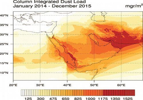
Figure 3. Averaged difference (WDE–NDE) in the incoming shortwave (a) and longwave (b) radiation at the surface.
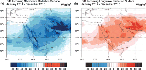
Figure 4. Averaged difference of the model simulations (WDE – NDE) in the temperature at 2 m (a), and column integrated water load (b).
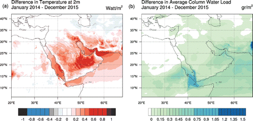
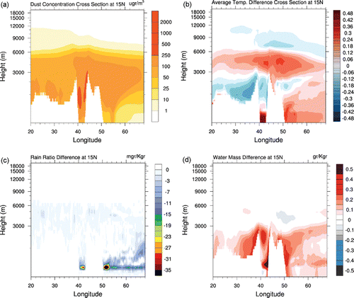
Figure 5. Averaged vertical distribution of (a) dust concentration from the WDE simulation, (b) differences in vertical temperature, (c) differences in vertical rain ratio, and (d) differences in water mass between the model simulations (WDE–NDE) along the 15°N pathway for the entire simulation period (January 2014–December 2015).